


Here is the news and weather briefing for Macon County.
GENERAL OUTLOOK
Showers and thunderstorms are possible today as a cold front crosses the area, but unseasonably warm weather continues through Saturday. Below-normal temperatures and widespread light rain is expected Sunday with cool but drier weather on Monday. Drier and warmer weather will return to the area Tuesday through Thursday of next week.
Scattered thunderstorms are expected this afternoon and evening, with a few storms becoming strong to severe with damaging wind gusts the primary threat. Hail is unlikely, though it cannot be ruled out.
---BEGIN SPONSOR SEGMENT---
Weather Sponsor
Day Sponsor

Macon Media is being underwritten today by Franklin Office Supply. Visit their store at 161 Highlands Road in Franklin or check out their website.
Support Macon Media
If you receive value from what Macon Media provides to the community, please consider becoming a supporter and contribute at least a dollar a month. Those who support Macon Media with at least a dollar a month receive early access to video of some events and meetings before they are made public on the website. Videos and news involving public safety are not subject to early access.
Or, if you prefer Pay Pal, try PayPal.me/MaconMedia
---END SPONSOR SEGMENT------
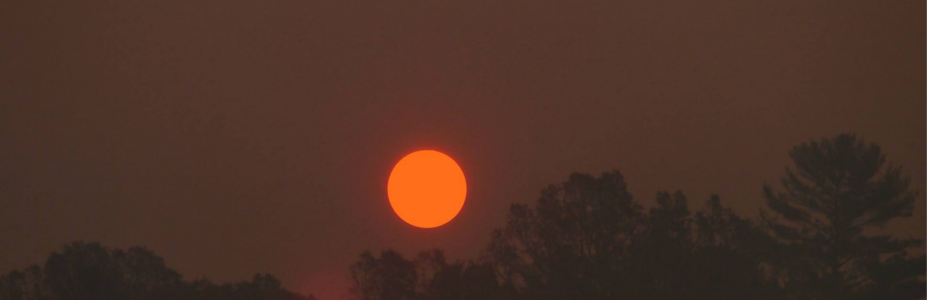
Local Weather
General Forecast Through Sunday Night

Franklin Area
Today
A 50 percent chance of showers and thunderstorms, mainly after 2pm. Mostly cloudy, with highs near 80. Calm winds in the morning increasing to come out of the northwest 5 to 10 mph in the afternoon. New rainfall amounts between a tenth and quarter of an inch, except higher amounts possible in thunderstorms.
Tonight
A 30 percent chance of showers and thunderstorms before 8pm. Patchy fog after 11pm. Otherwise, mostly cloudy, with lows in the mid 50s. Winds out of the north 3 to 6 mph. New rainfall amounts of less than a tenth of an inch, except higher amounts possible in thunderstorms.
Saturday
Mostly cloudy, then gradually becoming sunny, with highs in the low-to-mid 70s. Winds out of the northwest 3 to 7 mph.
Saturday Night
A 30 percent chance of rain, mainly after midnight. Mostly cloudy, with lows in the mid 40s. Winds out of the northwest 5 to 10 mph decreasing and shifting to light winds out of the north after midnight.
Sunday
Rain likely, mainly between 9am and noon, then showers likely after noon. Mostly cloudy, with highs in the mid-to-upper 50s. Chance of rain is 70%.
Sunday Night
A 30 percent chance of showers before 8pm. Mostly cloudy, with lows around 40.
Highlands Plateau
Today
A 40 percent chance of showers and thunderstorms, mainly after 2pm. Partly sunny, with highs in the lower 70s. Winds out of the northwest 5 to 10 mph. New rainfall amounts between a tenth and quarter of an inch, except higher amounts possible in thunderstorms.
Tonight
Patchy fog after 11pm. Otherwise, mostly cloudy, with lows in the low-to-mid 50s. Winds out of the northwest 5 to 15 mph.
Saturday
A slight chance of showers between 3pm and 5pm, then a slight chance of rain after 5pm. Mostly sunny, with highs in the upper 60s. Winds out of the northwest 5 to 10 mph. Chance of rain is 20%.
Saturday Night
A 30 percent chance of rain, mainly after 10pm. Mostly cloudy, with lows in the mid 40s. Winds out of the northwest 5 to 10 mph.
Sunday
Rain likely before noon, then showers likely after noon. Mostly cloudy, with highs near 50. Chance of rain is 70%.
Sunday Night
A 30 percent chance of showers before 8pm. Mostly cloudy, with lows around 40.
Otto and South Central Macon County
Today
A 40 percent chance of showers and thunderstorms, mainly after 2pm. Mostly cloudy, with highs in the upper 70s. Calm winds in the morning increasing to come out of the northwest 5 to 10 mph in the afternoon. New rainfall amounts between a quarter and half of an inch possible.
Tonight
A 30 percent chance of showers and thunderstorms, mainly before 7pm. Patchy fog after 11pm. Otherwise, mostly cloudy, with lows in the mid 50s. Winds out of the north around 5 mph. New rainfall amounts of less than a tenth of an inch, except higher amounts possible in thunderstorms.
Saturday
Mostly sunny, with highs in the mid 70s. Winds out of the northwest 5 to 10 mph.
Saturday Night
A 30 percent chance of rain, mainly after 11pm. Mostly cloudy, with lows in the mid 40s. Winds out of the north 5 to 10 mph.
Sunday
Rain likely before noon, then showers likely after noon. Mostly cloudy, with highs in the mid 50s. Chance of rain is 70%.
Sunday Night
A 30 percent chance of showers before 7pm. Mostly cloudy, with lows in the lower 40s.
Nantahala Area
Today
A chance of showers and thunderstorms before 8am, then a chance of showers, then a chance of showers and thunderstorms after 9am. Patchy fog between 7am and 10am. Otherwise, mostly cloudy, with highs in the lower 70s. Winds out of the west 5 to 10 mph. Chance of rain is 50%. New rainfall amounts between a tenth and quarter of an inch, except higher amounts possible in thunderstorms.
Tonight
Patchy fog after 9pm. Otherwise, mostly cloudy, with lows in the lower 50s. Winds out of the northwest 5 to 10 mph.
Saturday
Patchy fog before 9am. Otherwise, partly sunny, with highs in the mid 60s. Winds out of the northwest 5 to 10 mph.
Saturday Night
A 30 percent chance of rain, mainly after 1am. Mostly cloudy, with lows in the low-to-mid 40s. Winds out of the north 5 to 10 mph.
Sunday
Rain likely, mainly between 9am and noon, then showers likely after noon. Mostly cloudy, with highs in the lower 50s. Chance of rain is 70%.
Sunday Night
A 30 percent chance of showers before 8pm. Mostly cloudy, with lows around 40.
Back to Top
Hazards
Scattered thunderstorms are expected this afternoon and evening, with a few storms becoming strong to severe with damaging wind gusts the primary threat. Hail is unlikely, though it cannot be ruled out.
Back to Top Pollen
Pollen levels are expected to be in the high range (10.5 out of 12) today with Oak, Beech, and Birch being the main culprits. Tomorrow is expected to be in the high range (10.7 out of 9.1).
Record Weather Events for April 19th
Record weather events for this date in Macon County
(1872-2016)
Highest Temperature 88°F in Franklin in 1976
Lowest Temperature 17°F in Highlands in 1983
Greatest One-Day Rain 4.46 inches in Highlands in 1901
Greatest One-Day Snowfall 1.0 inches in Highlands in 1983
Weather Extremes for Macon County for the month of April Data available from 1872
Highest Temperature 91°F in Franklin on 04-26-1986
Lowest Temperature 13°F in Highlands on 04-01-1987
Greatest Rainfall 7.00 inches in Highlands on 04-07-1895 (also a state record)
Greatest Snowfall 9.5 inches in Franklin on 04-04-1987
Record Weather Events for April 19th in North Carolina
rdrd Highest Temperature 95°F in Louisburg, Franklin County in 1976
Lowest Temperature 6°F in Mount Mitchell, Yancey County in 1983
Greatest Rainfall 5.29 inches in Fletcher, Buncombe County in 2019
Greatest Snowfall 6.0 inches in Banner Elk, Avery County in 1983
Weather Extremes for North Carolina for the month of April Data available from 1872
Highest Temperature 102°F in Carthage, Moore County on 04-29-1981
Lowest Temperature 1°F in Mount Mitchell, Yancey County on 04-08-2007
Greatest Rainfall 7.30 inches in Lake Toxaway, Transylvania County on 04-16-2011
Greatest Snowfall 19.00 in Mount Mitchell, Yancey County on 04-11-2003
Back to Top
Macon Calendar
(send your event to calendar@maconmedia.com)
Music Lineup for Friends of the Greenway, Inc.
Frog Quarters Music Schedule (located at 573 East Main Street in Franklin)
April 2024 Schedule
4-20-24—Singer/Songwriter Zip Robertson returns to Frog Quarters after a long hiatus. Zip hales recently from Coffee Shops and venues in Swain County and Frog Quarters is happy he’s travelling across the hill to be with us again.
4-27-24—-------------SUPER ADOPTION DAY at Frogs!!
PAWSITIVE (the Macon Co. Animal Shelter Volunteers) and AARC (the Appalachian Animal Rescue Center) will be conducting a great Adoption Day on the outside, while on the inside several of our area talented musicians will bring their talents to Frog Quarters. On the slate are:
George James
Bill Peterson
The Shifty Sisters
Charley Simmons
Dave Stewart
Frog Quarters is open 9a to 2p, Wednesdays thru Saturdays—beside the River Bridge. We are the Non-Profit supporting the Greenway with monies from sales from our Coffee & Gift Shop, Memberships and Donations. As always, thank you for your support!
2nd Annual Youth Mental Health Rally and March
Sunday, April 28, 2024 From 2pm to 5pm
Organized and presented by Gracie Parker/Why Us Kids? Come join us for the 2nd Annual Youth Mental Health Rally at the Gazebo, downtown Franklin NC to raise awareness to the youth mental health crisis in our community, county and State. Learn more at https://www.facebook.com/events/3684885531726614
Mountain Findings
432 Spruce Street (physical)
Highlands, North Carolina 28741
Web: MountainFindings.org
Mountain Findings (a thrift store) is open every Thursday, Friday, and Saturday from 10 am to 1 pm until October 2023.
News Briefing
Global National: April 18, 2024 | What is driving the sudden spike in gas prices in eastern Canada?
ABC World News Tonight with David Muir Full Broadcast - April 18, 2024
"CBS Weekend News" Full Broadcast | April 18, 2024
NBC Nightly News Full Broadcast - April 18, NBC News
PBS NewsHour full episode, (April 18, 2024)
Back to Top
On This Day
April 19th is the 109th day of the year in the Gregorian calendar. 256 days remain until the end of the year. Historical Events

Historical Events
(Please note that the Wikipedia articles often contain a bibliography and links to where you can learn more about a historical event)
796 – King Æthelred I of Northumbria is murdered in Corbridge by a group led by his ealdormen, Ealdred and Wada. The patrician Osbald is crowned, but abdicates within 27 days.
• [Wikipedia]
AD 65 – The freedman Milichus betrays Piso's plot to kill the Emperor Nero and all the conspirators are arrested.
607 - Comet 1P/607 H1 (Halley) approaches within 0.0898 AUs (8.35 million miles) of Earth
531 – Battle of Callinicum: A Byzantine army under Belisarius is defeated by the Persians at Raqqa (northern Syria).
797 – Empress Irene organizes a conspiracy against her son, the Byzantine emperor Constantine VI. He is deposed and blinded. Shortly after, Constantine dies of his wounds; Irene proclaims herself basileus.
1012 - Martyrdom of Alphege in Greenwich, London
1451 - Alam Shah of Delhi resigns throne
1506 – The Lisbon Massacre begins, in which accused Jews are being slaughtered by Portuguese Catholics.
1524 - Pope Clemens VII fires Neth inquisitor-general French Van de Holly
1529 – Beginning of the Protestant Reformation: After the Second Diet of Speyer bans Lutheranism, a group of rulers (German: Fürst) and independent cities protests the reinstatement of the Edict of Worms.
1539 – The Treaty of Frankfurt between Protestants and the Holy Roman Emperor is signed.
1591 - Chartres surrenders to King Henry IV in France
1608 – In Ireland: O'Doherty's Rebellion is launched by the Burning of Derry.
1677 – The French army captures the town of Cambrai held by Spanish troops.
1713 – With no living male heirs, Charles VI, Holy Roman Emperor, issues the Pragmatic Sanction of 1713 to ensure that Habsburg lands and the Austrian throne would be inheritable by a female; his daughter and successor, Maria Theresa was not born until 1717.
1770 – Captain James Cook, still holding the rank of lieutenant, sights the eastern coast of what is now Australia.
1770 – Marie Antoinette marries Louis XVI of France in a proxy wedding.
1775 - American Revolutionary War: Paul Revere, William Dawes and Samuel Prescott are captured by British troops riding from Lexington to Concord, Prescott escapes to warn Concord
1775 – American Revolutionary War: The war begins with an American victory in Concord during the battles of Lexington and Concord.
1782 – John Adams secures Dutch recognition of the United States as an independent government. The house which he had purchased in The Hague becomes the first American embassy.
1809 – An Austrian corps is defeated by the forces of the Duchy of Warsaw in the Battle of Raszyn, part of the struggles of the Fifth Coalition. On the same day the Austrian main army is defeated by a First French Empire Corps led by Louis-Nicolas Davout at the Battle of Teugen-Hausen in Bavaria, part of a four-day campaign that ended in a French victory.
1810 – Venezuela achieves home rule: Vicente Emparán, Governor of the Captaincy General is removed by the people of Caracas and a junta is installed.
1818 – French physicist Augustin Fresnel signs his preliminary "Note on the Theory of Diffraction" (deposited on the following day). The document ends with what we now call the Fresnel integrals.
1839 – The Treaty of London establishes Belgium as a kingdom and guarantees its neutrality.
1861 – American Civil War: Baltimore riot of 1861: A pro-Secession mob in Baltimore attacks United States Army troops marching through the city.
1903 – The Kishinev pogrom in Kishinev (Bessarabia) begins, forcing tens of thousands of Jews to later seek refuge in Palestine and the Western world.
1927 – Mae West is sentenced to ten days in jail for obscenity for her play Sex.
1933 - FDR announces US will leave gold standard
1942 – World War II: In Poland, the Majdan-Tatarski ghetto is established, situated between the Lublin Ghetto and a Majdanek subcamp.
1943 – World War II: In Poland, the Warsaw Ghetto Uprising begins, after German troops enter the Warsaw Ghetto to round up the remaining Jews.
1943 – Albert Hofmann deliberately doses himself with LSD for the first time, three days after having discovered its effects on April 16.
1956 – Actress Grace Kelly marries Prince Rainier of Monaco.
1960 – Students in South Korea hold a nationwide pro-democracy protest against president Syngman Rhee, eventually forcing him to resign.
1971 – Sierra Leone becomes a republic, and Siaka Stevens the president.
1971 – Launch of Salyut 1, the first space station.
1971 – Charles Manson is sentenced to death (later commuted to life imprisonment) for conspiracy in the Tate–LaBianca murders.
1973 – The Portuguese Socialist Party is founded in the German town of Bad Münstereifel.
1975 – India's first satellite Aryabhata launched in orbit from Kapustin Yar, Russia.
1975 – South Vietnamese forces withdrew from the town of Xuan Loc in the last major battle of the Vietnam War.
1984 – Advance Australia Fair is proclaimed as Australia's national anthem, and green and gold as the national colours.
1985 – Two hundred ATF and FBI agents lay siege to the compound of the white supremacist survivalist group The Covenant, The Sword, and the Arm of the Lord in Arkansas; the CSA surrenders two days later.
1987 – The Simpsons first appear as a series of shorts on The Tracey Ullman Show, first starting with Good Night.
1989 – A gun turret explodes on the USS Iowa, killing 47 sailors.
1993 – The 51-day FBI siege of the Branch Davidian building in Waco, Texas, USA, ends when a fire breaks out. 76 Davidians, including eighteen children under the age of ten, died in the fire.
1995 – Oklahoma City bombing: The Alfred P. Murrah Federal Building in Oklahoma City, USA, is bombed, killing 168 people including 19 children under the age of six.
1999 – The German Bundestag returns to Berlin.
2000 – Air Philippines Flight 541 crashes in Samal, Davao del Norte, killing all 131 people on board.
2005 – Cardinal Joseph Ratzinger is elected to the papacy and becomes Pope Benedict XVI.
2011 – Fidel Castro resigns as First Secretary of the Communist Party of Cuba after holding the title since July 1961.
2013 – Boston Marathon bombing suspect Tamerlan Tsarnaev is killed in a shootout with police. His brother Dzhokhar is later captured hiding in a boat inside a backyard in the suburb of Watertown.
2018 - Miguel Diaz-Canel is elected Cuba's new president after former president Raúl Castro steps down
2018 - Senator Tammy Duckworth (Illinois) is the first parent to bring a baby into the US Senate, a day after the Senate votes to allow babies on the chamber's floor
2018 - King Mswati III of Swaziland changes the name of Swaziland to eSwatini, or “land of the Swati”
2020 – A killing spree in Nova Scotia, Canada, leaves 22 people and the perpetrator dead, making it the deadliest rampage in the country's history.
2020 - Together At Home concert for COVID-19 aid curated by Lady Gaga and streamed worldwide
2020 - UK COVID-19 death toll reaches 16,060 (hospitals only), as "The Sunday Times" criticizes Boris Johnson's government's response, saying they "sleepwalked into disaster"
2020 - Turkey passes Iran to become the Middle Eastern country with the most COVID-19 cases with 86,306 infections, Iran continues to have the most deaths
2021 - NASA successfully flies its drone helicopter Ingenuity on Mars, first powered aircraft to fly on another world
2021 - Cuba's Communist party announces Miguel Díaz-Canel will replace Raúl Castro as party leader, after the latter steps down
Back to Top
Support Macon Media
If you receive value from what Macon Media provides to the community, please consider becoming a supporter and contribute at least a dollar a month. Those who support Macon Media with at least a dollar a month receive early access to video of some events and meetings before they are made public on the website. Videos and news involving public safety are not subject to early access.
Become a Patron!
Or, if you prefer Pay Pal, try PayPal.me/MaconMedia
Published at 5:00am on Friday, April 19, 2023
Author: Bobby Coggins
Resources used to compile the information in this article include, but are not limited to rthe following websites or books: MaconMedia.com, youtube.com, weather.gov, airnow.gov, wikipedia.com, onthisday.com, ncdcr.gov, ncsu.edu, utah.edu, https://www.microbe.tv/twiv/, wolfram.com, biorxiv.org, aps.org, nejm.org, plos.org, cell.com, researchsquare.com, cureus.com, spc.noaa.gov, nhc.noaa.gov, ncdenr.org, medrxiv.org, archive.org, ncpedia.org, nasa.gov, https://ww2days.com, nih.gov, carolinapublicpress.org, microbe.tv, smokymountainnews.com, psypost.org, blogspot.com, pollen.com, franklinnc.com, maconnc.org, spaceweather.com, solarham.com, loc.gov, ncleg.net, senate.gov, house.gov, whitehouse.gov, drudgereport.com, politico.com, realclearpolitics.com, ushmm.org, This Day in North Carolina History, World War II Day By Day, The Holocaust Encyclopedia, The Timetables of History, The Rise and Fall of the Third Reich, The Hitchhiker's Guide to the Galaxy, The World History and Book of Facts (multiple years), On This Day In History: Over 4,000 facts, The NASA Archives. 60 Years in Space, This Day in North Carolina History, The Smithsonian History of Space Exploration: From the Ancient World to the Extraterrestrial Future, Spaceflight, 2nd Edition: The Complete Story from Sputnik to Curiousity, The Story of Civilization (11 volumes), The Decline and Fall of the Roman Empire, American History, Volume 1: 1492-1877, American History, Volume 2: 1877 - Present, A Complete Chronolgy of the Second World War. Weather and Almanac data and information sources: Sources (except where otherwise credited): heavens-above.com, Ian Webster's Github, National Centers for Environmental Prediction, The National Weather Service, National Oceanic Atmospheric Administration, National Hurricane Center, Penn State University Electronic Wall Map, The State Climate Office of North Carolina, Storm Prediction Center, U.S. Naval Observatory, University of Utah Department of Atmospheric Sciences, and the Weather Prediction Center.
Back to Top
Support Macon Media
If you receive value from what Macon Media provides to the community, please consider becoming a supporter and contribute at least a dollar a month. Those who support Macon Media with at least a dollar a month receive early access to video of some events and meetings before they are made public on the website. Videos and news involving public safety are not subject to early access.
Or, if you prefer Pay Pal, try PayPal.me/MaconMedia
Published at 5:00am on Friday, April 19, 2023
Author: Bobby Coggins
Resources used to compile the information in this article include, but are not limited to rthe following websites or books: MaconMedia.com, youtube.com, weather.gov, airnow.gov, wikipedia.com, onthisday.com, ncdcr.gov, ncsu.edu, utah.edu, https://www.microbe.tv/twiv/, wolfram.com, biorxiv.org, aps.org, nejm.org, plos.org, cell.com, researchsquare.com, cureus.com, spc.noaa.gov, nhc.noaa.gov, ncdenr.org, medrxiv.org, archive.org, ncpedia.org, nasa.gov, https://ww2days.com, nih.gov, carolinapublicpress.org, microbe.tv, smokymountainnews.com, psypost.org, blogspot.com, pollen.com, franklinnc.com, maconnc.org, spaceweather.com, solarham.com, loc.gov, ncleg.net, senate.gov, house.gov, whitehouse.gov, drudgereport.com, politico.com, realclearpolitics.com, ushmm.org, This Day in North Carolina History, World War II Day By Day, The Holocaust Encyclopedia, The Timetables of History, The Rise and Fall of the Third Reich, The Hitchhiker's Guide to the Galaxy, The World History and Book of Facts (multiple years), On This Day In History: Over 4,000 facts, The NASA Archives. 60 Years in Space, This Day in North Carolina History, The Smithsonian History of Space Exploration: From the Ancient World to the Extraterrestrial Future, Spaceflight, 2nd Edition: The Complete Story from Sputnik to Curiousity, The Story of Civilization (11 volumes), The Decline and Fall of the Roman Empire, American History, Volume 1: 1492-1877, American History, Volume 2: 1877 - Present, A Complete Chronolgy of the Second World War. Weather and Almanac data and information sources: Sources (except where otherwise credited): heavens-above.com, Ian Webster's Github, National Centers for Environmental Prediction, The National Weather Service, National Oceanic Atmospheric Administration, National Hurricane Center, Penn State University Electronic Wall Map, The State Climate Office of North Carolina, Storm Prediction Center, U.S. Naval Observatory, University of Utah Department of Atmospheric Sciences, and the Weather Prediction Center.


