


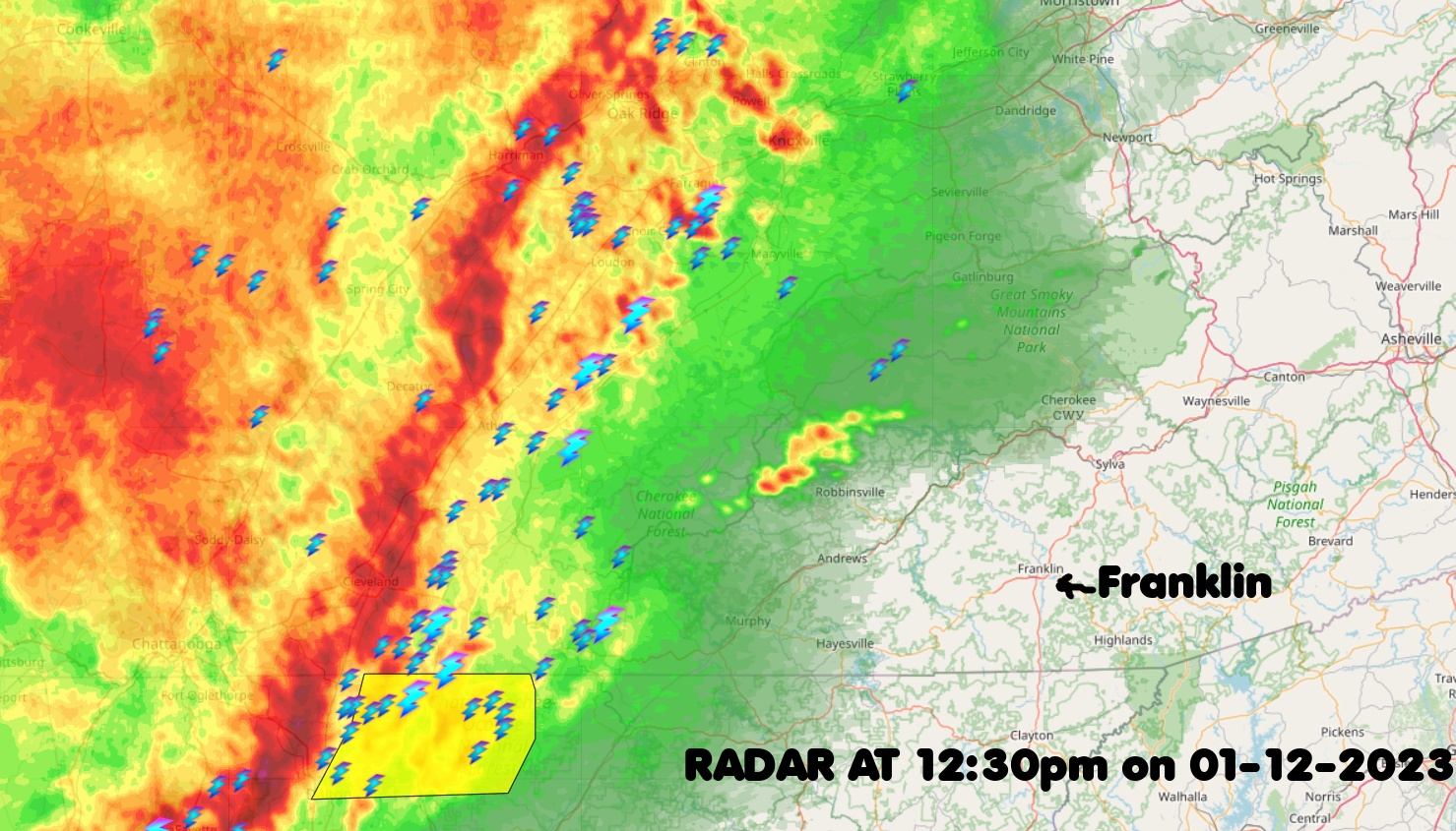
A line of storms is approaching Macon County from the west, with the individual storm cells moving from the southeast to the northeast. They should be here within an hour or so.
Be prepared for brief heavy downpours and strong winds. If you are out and about, consider finding somewhere to park while they come through the county to avoid being in hazardous conditions while on the road. Winds could knock out power and hail up to an inch is not out of the realm of possibility.
Key Messages:
1. A band of showers and thunderstorms will move across the area
today, with the possibility of some strong to severe thunderstorms
2. Strong gusty winds over some of the higher elevations through
today
3. Rain showers will transition to snow showers over the higher
terrain later tonight with accumulating snow beginning in the higher elevations. Most of us in the valleys will only be getting a dusting up to maybe an inch or so.
WEATHER SPONSOR
Adams, an Old Castle Company
http://facebook.com/Adams.Oldcastle.Franklin.NC
DAY SPONSOR
Franklin Health and Fitness
#WNCscan #MaconSafety #MaconTrafic
Published at 12:40pm on Thursday, January 12, 2023


0 comments :
Post a Comment