


Outlook
A disturbance pushing into the region will lead to scattered shower and thunderstorm activity today. A ridge building aloft will support generally quiet weather this weekend into early next week.
THREE DAY GFS FORECAST
This animated image shows a forecast of precipitation, air pressure and thickness level (cold-air damming) for three days in six-hour increments.
Green, Yellow, and Red indicate rain. Orange and Purple Indicate Freezing Rain or other freezing precipitation. Blue indicates snow.

WEATHER SPONSOR

Adams Products, a Division of Oldcastle is underwriting the daily weather briefing & public safety updates for the month.
Open 7:30 AM to 4:00 PM, M-F, located at 895 Hickory Knoll Road, Franklin, NC. Visit our Facebook page at:
https://www.facebook.com/Adams.Oldcastle.Franklin.NC/
All your masonry needs are available. Our phone number is 828.524.8545, the public is welcome, we’ll help you with your with your next project.
Weather Hazards
A Wind Advisory is in effect for Macon County for today. Scattered power outages are possible.
Wind Advisory
URGENT - WEATHER MESSAGE
National Weather Service Greenville-Spartanburg SC
1109 PM EDT Thu Apr 25 2019
...GUSTY NORTHWEST WINDS EXPECTED ACROSS THE NORTH CAROLINA AND SOUTH CAROLINA MOUNTAINS AS WELL AS PORTIONS OF NORTHEAST GEORGIA LATE FRIDAY MORNING INTO FRIDAY EVENING...
.As a cold front pushes through the area from west to east beginning Friday morning, expect a tightening pressure gradient behind this feature to allow for gusty northwesterly across the North Carolina and South carolinas mountains, as well as portions of northeast Georgia late Friday morning through Friday evening. Gusts are expected to subside and fall below criteria into Friday night as the pressure gradient relaxes.
...WIND ADVISORY REMAINS IN EFFECT FROM 11 AM TO 8 PM EDT FRIDAY...
* LOCATIONS...North Carolina mountains, South Carolinas mountains, and portions of northeast Georgia.
* HAZARDS...Gusty northwest winds.
* TIMING...Late Friday morning through Friday evening, peaking Friday afternoon.
* WINDS...Northwest 20 to 30 mph with gusts up to 50 mph.
* IMPACTS...Strong winds may blow down limbs, trees, and power lines. Scattered power outages are possible.
PRECAUTIONARY/PREPAREDNESS ACTIONS...
A Wind Advisory means that winds of 35 mph are expected. Winds this strong can make driving difficult, especially for high profile vehicles. Use extra caution.
Stay tuned to NOAA Weather Radio or your favorite source of weather information for the latest updates. Additional details can be found at www.weather.gov/gsp.
CROWDFUNDING OR DAY SPONSORSHIP OPPORTUNITIES
If you receive value from what Macon Media provides to the community, please consider becoming a supporter and contribute at least a dollar a month. Those who support Macon Media with at least a dollar a month receive early access to video of some events and meetings before they are made public on the website. Videos and news involving public safety are not subject to early access.
Patreon Subscriber History May 2014 to Present

If you have a business or event you are interested in sponsorship opportunities or underwriting coverage, send an email to editor@MaconMedia.com for more information. Serious inquiries only.
Thank You to the people who have been sending in donations and those businesses who are underwriting coverage of news and events. You have kept Macon Media online.
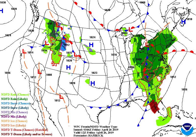
WEATHER FORECAST MAPS
Forecast maps for 7 am, 1 pm, and 7 pm.
[click on any image in this article to enlarge]


FRANKLIN AREA FORECAST
Today
Showers, mainly before 1pm. Highs in the mid-to-upper 60s. Winds out of the southwest 5 to 10 mph shifting to come out of the northwest 15 to 25 mph in the afternoon. Winds could gust as high as 35 mph. Chance of precipitation is 80%. New precipitation amounts between a tenth and quarter of an inch possible.
Tonight
Mostly clear, with a low in the lower 40s. Winds out of the northwest 5 to 15 mph, with gusts as high as 20 mph.
Saturday
Sunny, with a high in the mid-70s. Light and variable winds shifting to come out of the southwest 5 mph by midmorning.
Saturday Night
A 20 percent chance of showers after 1am. Mostly cloudy, with a low around 50. Winds out of the southwest 3 to 5 mph.
Sunday
A 20 percent chance of showers after 2pm. Partly sunny, with a high in the upper 70s.
Sunday Night
Partly cloudy, with a low in the upper 40s.
OTTO AREA FORECAST
Today
Showers, mainly before noon. Highs in the mid-to-upper 60s. Winds out of the southwest 5 to 10 mph shifting to come out of the northwest 15 to 20 mph in the afternoon. Winds could gust as high as 35 mph. Chance of precipitation is 80%. New precipitation amounts between a tenth and quarter of an inch possible.
Tonight
Mostly clear, with a low in the low-to-mid 40s. Winds out of the northwest 10 to 15 mph, with gusts as high as 25 mph.
Saturday
Sunny, with a high in the mid-to-upper 70s. Winds out of the northwest 5 to 10 mph shifting to come out of the southwest in the afternoon.
Saturday Night
Mostly cloudy, with a low around 50. Winds out of the southwest around 6 mph.
Sunday
A slight chance of showers before 8am, then a slight chance of showers after 2pm. Mostly sunny, with a high in the upper 70s. Chance of precipitation is 20%.
Sunday Night
Partly cloudy, with a low around 50.
HIGHLANDS PLATEAU AREA FORECAST
Today
Showers, mainly before 1pm. Patchy fog before 7am. Highs in the upper 50s. Winds out of the northwest 10 to 15 mph increasing to 20 to 25 mph in the afternoon. Winds could gust as high as 40 mph. Chance of precipitation is 80%. New precipitation amounts between a quarter and half of an inch possible.
Tonight
Mostly clear, with a low around 40. Winds out of the northwest 15 to 25 mph, with gusts as high as 40 mph.
Saturday
Sunny, with a high near 65. Winds out of the northwest 5 to 10 mph shifting out of the southwest in the afternoon.
Saturday Night
Mostly cloudy, with a low around 50. Winds out of the southwest 5 to 10 mph.
Sunday
A 20 percent chance of showers after 2pm. Mostly sunny, with a high in the mid-60s.
Sunday Night
Partly cloudy, with a low around 50.
NANTAHALA AREA FORECAST
Today
Showers, mainly before 2pm. Patchy fog before 7am. High near 60. Winds ouut of the northwest 10 to 15 mph increasing to 20 to 25 mph in the afternoon. Winds could gust as high as 45 mph. Chance of precipitation is 90%. New precipitation amounts between a quarter and half of an inch possible.
Tonight
Mostly clear, with a low around 40. Winds out of the northwest 10 to 20 mph, with gusts as high as 30
mph.
Saturday
Sunny, with a high near 70. Winds out of the northwest around 5 to 10 mph shifting to come out of the southwest in the afternoon.
Saturday Night
A 20 percent chance of showers after midnight. Mostly cloudy, with a low around 50. Winds out of the southwest 5 to 10 mph.
Sunday
A 20 percent chance of showers after 2pm. Partly sunny, with a high in the upper 60s.
Sunday Night
Partly cloudy, with a low around 50.
Macon County Almanac for April 26, 2019
Highest Temperature 91°F in Franklin in 1986
Lowest Temperature 23°F in Highlands in 1919
Greatest Rainfall 3.24 inches in Highlands in 1939
Greatest Snowfall no measurable snow has fallen on this date since records started being kept in 1872
Weather Extremes for Macon County for the month of April
Data available from 1873 to 2018
Highest Temperature 91°F in Franklin on 04-26-1986
Lowest Temperature 13°F in Highlands on 04-01-1987
Greatest Rainfall 7.00 inches in Highlands on 04-07-1895
Greatest Snowfall 9.5 inches in Franklin on 04-04-1987
Published at 2:45am on April 26, 2019


0 comments :
Post a Comment