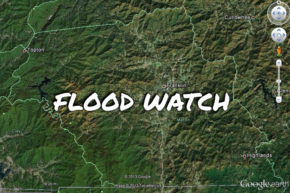
Another period of heavy rain is in the forecast for Macon County. Here is the weather update for this morning that I've posted on my Public Safety Page:
Strong high pressure will move off the east coast today as moisture increases ahead of the next cold front. This cold front is forecast to stall out to our south on Tuesday. Low pressure is expected to move along the front to reach Macon County on Wednesday.
Today: A chance of rain, mainly after 2pm. Mostly cloudy, with a high near 55. Calm wind becoming southwest 5 to 9 mph in the morning. Chance of precipitation is 40%. New precipitation amounts between a tenth and quarter of an inch possible.
Hazardous Weather Outlook:
...FLASH FLOOD WATCH IN EFFECT FROM THIS EVENING THROUGH MONDAY AFTERNOON...
A strong upper low will lift across the plains states tonight to a position over the Great Lakes states by Monday morning. Widespread rain is expected to develop over the western Carolina and northeast Georgia tonight as a warm front lifts northward from the Gulf of Mexico. Some uncertainty remains in how much rain we'll receive out of this in Macon County. Some computer models suggest 1 to 3 inches, and others suggest 2 to 4 inches. However, all of them agree that the bulk of the rain will fall with a 9 hour period on Monday. That is why the National Weather Service has put us under a Flood Watch.
The heaviest rain should fall to our south...but that is where the headwaters of the Little Tennessee and Cullasaja Rivers are...and that water will have to come through the length of our county as it flows north.
If you live or work in a low-lying area, please be prepared for the possibility of some flooding.
Tonight: Rain. The rain could be heavy at times. Patchy fog after 10pm. Low around 46. Southwest wind around 6 mph becoming calm after midnight. Chance of precipitation is 100%. New precipitation amounts between 1 and 2 inches possible.
Monday: A chance of showers, mainly before 10am. The rain could be heavy at times. Mostly cloudy, with a high near 65. Light northwest wind becoming west 10 to 15 mph in the morning. Winds could gust as high as 26 mph. Chance of precipitation is 30%. New precipitation amounts of less than a tenth of an inch possible.
Monday Night: Mostly cloudy, with a low around 37. North wind 5 to 7 mph.
Text from the National weather Service regarding our Flood Watch:
***FLOOD WATCH***
NATIONAL WEATHER SERVICE GREENVILLE-SPARTANBURG SC
308 AM EST SUN FEB 10 2013
...HEAVY RAIN TONIGHT OVER PARTS OF THE WESTERN CAROLINAS AND NORTHEAST GEORGIA...
.LOW PRESSURE WILL MOVE ACROSS THE NORTHERN PLAINS OVER THE NEXT 24 HOURS. AS IT DOES SO...A WARM FRONT WILL LIFT NORTHWARD FROM THE GULF COAST...CROSSING THE REGION TONIGHT. WIDESPREAD RAIN WILL DEVELOP ALONG AND AHEAD OF THE FRONT. UPSLOPE FLOW ACROSS THE SOUTHERN APPALACHIANS WILL HELP TO LOCALLY INCREASE RAINFALL RATES...AND FROM 1 TO 3 INCHES OF RAIN IS LIKELY ACROSS MOST OF NORTHEAST GEORGIA...THE WESTERN UPSTATE OF SOUTH CAROLINA AND THE SOUTHERN MOUNTAINS OF NORTH CAROLINA. THE RAIN WILL GRADUALLY COME TO AN END MONDAY MORNING.
...FLASH FLOOD WATCH IN EFFECT FROM THIS EVENING THROUGH MONDAY AFTERNOON...
THE NATIONAL WEATHER SERVICE IN GREENVILLE-SPARTANBURG HAS ISSUED
A
* FLASH FLOOD WATCH FOR PORTIONS OF NORTHEAST GEORGIA...WESTERN NORTH CAROLINA AND UPSTATE SOUTH CAROLINA...INCLUDING THE FOLLOWING AREAS...IN NORTHEAST GEORGIA...ELBERT...FRANKLIN...HABERSHAM...HART...RABUN AND STEPHENS. IN WESTERN NORTH CAROLINA...MACON...SOUTHERN JACKSON AND TRANSYLVANIA. IN UPSTATE SOUTH CAROLINA...ANDERSON...GREATER OCONEE...GREATER PICKENS...OCONEE MOUNTAINS AND PICKENS MOUNTAINS.
* FROM THIS EVENING THROUGH MONDAY AFTERNOON.
* HEAVY RAIN WILL DEVELOP ACROSS THE WATCH AREA TONIGHT. RAINFALL AMOUNTS ARE EXPECTED TO AVERAGE FROM 1 TO 3 INCHES ACROSS THE SOUTHERN APPALACHIANS...THE ADJACENT FOOTHILL LOCATIONS AND THE UPPER SAVANNAH RIVER VALLEY.
* RECENT HEAVY RAIN EVENTS HAVE LEFT THE GROUND VERY MOIST AND STREAM AND RIVER LEVELS HIGH. AS THE RAIN IS LIKELY TO FALL QUICKLY OVERNIGHT...FLASH FLOODING MAY DEVELOP ALONG SMALLER STREAMS. BY LATE TONIGHT AND MONDAY MORNING...SOME FLOODING WILL ALSO BE POSSIBLE ALONG LARGER STREAMS AND RIVERS.
PRECAUTIONARY/PREPAREDNESS ACTIONS...
A FLASH FLOOD WATCH MEANS THAT CONDITIONS MAY DEVELOP THAT LEAD TO FLASH FLOODING. FLASH FLOODING IS A VERY DANGEROUS SITUATION.
YOU SHOULD MONITOR LATER FORECASTS AND BE PREPARED TO TAKE ACTION SHOULD FLASH FLOOD WARNINGS BE ISSUED.


0 comments :
Post a Comment