


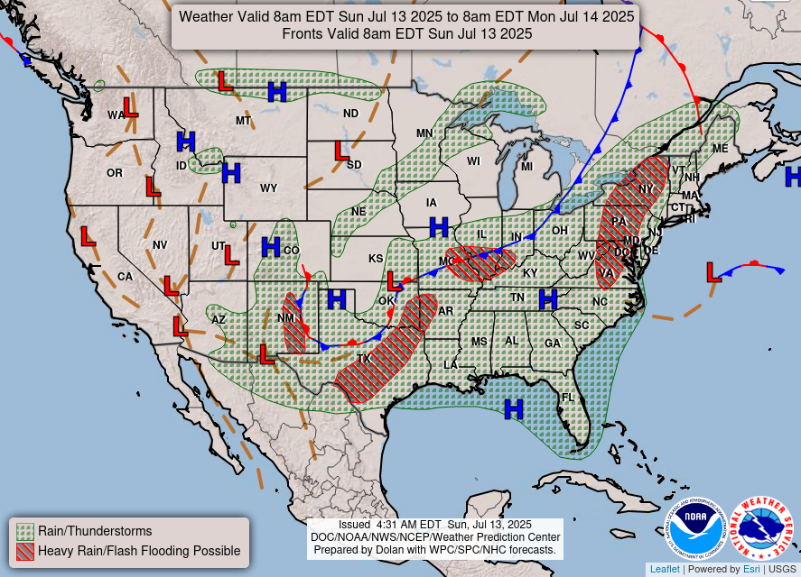
GENERAL OUTLOOK
Expect scattered thunderstorms and heavy downpours around the region each day of the coming week. A few storms could produce damaging wind gusts, particularly today and Monday. Daily high temperatures will be several degrees above normal at the beginning of the week but trend back to around normal Tuesday through Thursday.
WEATHER SPONSOR
DAY SPONSOR
This space available
GENERAL FORECAST
(since this is a quick forecast intended to cover the whole county, bear in mind that higher elevations may experience cooler temperatures than this and the lower elevations may experience higher temperatures than those in the forecast)
..TODAY...Sunny early this morning, then becoming mostly sunny. A chance of showers and thunderstorms this afternoon. Highs in the lower 80s. Winds out of the northwest around 5 mph. Chance of rain 40 percent.
...TONIGHT...Mostly clear. Lows in the lower 60s. Winds out of the northwest around 5 mph.
...MONDAY...Sunny in the morning, then partly sunny with showers and thunderstorms likely in the afternoon. Highs in the mid 80s. Northwest winds around 5 mph. Chance of rain 60 percent.
...MONDAY NIGHT...Mostly cloudy with a chance of showers and thunderstorms in the evening, then partly cloudy after midnight. Lows in the mid 60s. Winds out of the north around 5 mph. Chance of rain 50 percent.
...TUESDAY...Mostly sunny with a chance of showers and thunderstorms in the morning, then mostly cloudy with showers and thunderstorms in the afternoon. Humid with highs in the mid 80s. Light and variable winds, becoming south around 5 mph in the afternoon. Chance of rain 90 percent.
...TUESDAY NIGHT...Mostly cloudy. Showers and thunderstorms likely in the evening, then a chance of showers after midnight. Lows in the mid 60s. Chance of rain 70 percent.
HAZARDOUS WEATHER
Isolated strong to severe thunderstorms are possible this afternoon and evening. Damaging wind gusts will be the main hazard with any severe storms that develop. Some storms additionally may produce locally heavy rainfall.
Support Macon Media
If you receive value from what Macon Media provides to the community, please consider becoming a supporter and contribute at least a dollar a month. Those who support Macon Media with at least a dollar a month receive early access to video of some events and meetings before they are made public on the website. Videos and news involving public safety are not subject to early access.
Or, if you prefer Pay Pal, try PayPal.me/MaconMedia
Published at 5.00am on Sunday, July 13, 2025
Author: Bobby Coggins


0 comments :
Post a Comment