
Chinese Space Station Re-entry

China's 8.5 ton Tiangong-1 space station is expected to re-enter the earth's atmosphere sometime between now and April 10th. The Aerospace Corporation estimates the most likely time of re-entry as April 1st, plus or minus 3 days. For more information, check out the following links:
Sky and Telescope [LINK]
The Aerospace Corporation [LINK]
Here are a list of overhead passes for Tiangong-1 for the period the station is most likely to re-enter:
| DATE | Magnitude | Pass Start | Altitude | Direction | Maximum | Altitude | Direction | Pass End | Altitude | Direction | Day or Night |
| 29 Mar | -0.3 | 06:48:26 | 10° | WSW | 06:50:20 | 79° | SSE | 06:52:14 | 10° | ENE | visible |
| 29 Mar | - | 08:22:10 | 10° | NW | 08:23:14 | 13° | NNW | 08:24:19 | 10° | NNE | daylight |
| 29 Mar | - | 11:27:57 | 10° | NW | 11:29:36 | 25° | NNE | 11:31:15 | 10° | E | daylight |
| 29 Mar | - | 13:00:54 | 10° | W | 13:02:13 | 16° | SW | 13:03:32 | 10° | S | daylight |
| 30 Mar | -0.4 | 06:23:14 | 10° | WSW | 06:25:08 | 88° | NW | 06:27:03 | 10° | ENE | visible |
| 30 Mar | - | 07:57:03 | 10° | NW | 07:58:01 | 13° | NNW | 07:58:59 | 10° | NNE | daylight |
| 30 Mar | - | 11:02:35 | 10° | NW | 11:04:16 | 27° | NNE | 11:05:55 | 10° | E | daylight |
| 30 Mar | - | 12:35:39 | 10° | WSW | 12:36:47 | 14° | SW | 12:37:55 | 10° | S | daylight |
| 31 Mar | -0.4 | 05:57:10 | 10° | WSW | 05:59:05 | 78° | NNW | 06:00:58 | 10° | ENE | visible |
| 31 Mar | - | 07:31:01 | 10° | NW | 07:31:54 | 12° | NNW | 07:32:48 | 10° | NNE | daylight |
| 31 Mar | - | 10:36:21 | 10° | NW | 10:38:02 | 29° | NNE | 10:39:42 | 10° | E | daylight |
| 31 Mar | - | 12:09:31 | 10° | WSW | 12:10:29 | 13° | SW | 12:11:25 | 10° | S | daylight |
| 01 Apr | 0.2 | 05:30:14 | 10° | WSW | 05:32:07 | 70° | NNW | 05:34:01 | 10° | ENE | visible |
| 01 Apr | - | 07:04:04 | 10° | NW | 07:04:55 | 12° | N | 07:05:45 | 10° | NNE | daylight |
| 01 Apr | - | 10:09:13 | 10° | NW | 10:10:55 | 30° | NNE | 10:12:35 | 10° | E | daylight |
| 01 Apr | - | 11:42:30 | 10° | WSW | 11:43:17 | 12° | SW | 11:44:03 | 10° | S | daylight |
| 02 Apr | 0.5 | 05:02:24 | 10° | WSW | 05:04:18 | 66° | NNW | 05:06:11 | 10° | ENE | visible |
| 02 Apr | 2.0 | 06:36:14 | 10° | NW | 06:37:02 | 12° | N | 06:37:50 | 10° | NNE | visible |
| 02 Apr | - | 09:41:14 | 10° | NW | 09:42:55 | 31° | NNE | 09:44:35 | 10° | E | daylight |
| 02 Apr | - | 11:14:36 | 10° | WSW | 11:15:13 | 11° | SW | 11:15:50 | 10° | SSW | daylight |
STRUCTURE FIRE DONATIONS
Last Sunday afternoon, Steve Tippett's home caught fire and friends have established a GoFundMe to help.
LINK >> https://www.gofundme.com/tippett-family-house-fire
LOCAL OUTLOOK
Dry and unseasonably cool high pressure dominates our weather tonight. The next low-pressure system arrives for the weekend with light precipitation and well-below normal temperatures. The cold weather will persist through Monday as strong high pressure builds down the Appalachians. Temperatures rebound to near-normal by next Wednesday as the high pressure moves offshore in advance of the next system.
DAY SPONSOR
CARPENTER for SHERIFF is sponsoring Macon Media for today. Bryan Carpenter will be at the Highlands Library from noon to 2 pm today for a meet and greet and will discuss his ideas to make Macon Safe Again.
SCHEDULE
Highlands Library on March 24th from 12pm-2pm
Franklin Library on March 30th 1pm-5pm
I have set up some meet and greets, for those, who wish to sit down and talk about issues that you are having in your community and our county and how you and your family can find out my plans to MAKE MACON SAFE AGAIN. While people are at the meeting, they will be able to sign the petition to place me on the ballot in November. Thank you!
There will be light refreshments for all to enjoy!
Please share so the info can be passed along. Any questions; message me Facebook; or call and text me at 828-342-4283. I would be more than happy to answer them.
WEATHER SPONSOR

Adams Products, a Division of Oldcastle is underwriting the daily weather briefing & public safety updates for the month.
Open 7:30 AM to 4:00 PM, M-F, located at 895 Hickory Knoll Road, Franklin, NC. Visit our Facebook page at:
All your masonry needs are available. Phone number is 828.524.8545, public is welcome, we’ll help with your with your next project.
Weather Almanac for March 24th (1872-2016)
Record weather events for this date in Macon County
Highest Temperature 84°F in Highlands in 1929
Lowest Temperature 12°F in Highlands in 1915
Greatest Rainfall 4.35 inches in Highlands in 1917
Greatest One-Day Snowfall 5.0 inches in Highlands in 1983
Record Weather Events for March (1872-2017)
Highest Temperature 86°F at the Coweeta Experimental Station on March 15, 1967
Lowest Temperature -7°F in Highlands on March 7, 1899
Greatest Rainfall 6.43 inches in Highlands on March 29, 1898
Greatest One-Day Snowfall 25.5 inches at the Coweeta Experimental Station on March 13, 1993
THREE DAY OUTLOOK


Macon Media is experimenting with the three-day outlook to give a more tailored outlook for different areas of the county and will be experimenting with locations and formats. Feel free to give feedback at fb.com/MaconMEdiaNews
----------------------------------
FRANKLIN AREA
TODAY
Foggy in the morning. Cloudy and rainy with temperatures starting out around 40 and highs near 50 around 2 pm. Calm winds early, gradually increasing to 5 to 10 mph out of the south, then southeast. 60% chance of rain with rainfall amounts between a tenth and a quarter of an inch expected.
TONIGHT
Fog is expected to develop after 9 pm. Cloudy and rainy with lows in the lower 40s. Winds out of the southeast. Near 100% chance of rain with rainfall amounts between a quarter and half an inch expected.
SUNDAY
Patchy dense fog in the morning. Cloudy with highs near 50. Calm winds early and increasing to around 5 mph out of the southeast. 60% chance of rain with rainfall amounts between a tenth and a quarter of an inch expected.
SUNDAY NIGHT
Cloudy with lows near the mid-30s. Wind 5 to 10 mph out of the southeast shifting to come out of the northeast before midnight.
MONDAY
Mostly cloudy with highs near 50. 30% chance of rain, mainly before 9 am.
MONDAY NIGHT
Mostly cloudy with lows in the mid-to-upper 30s.
-----------------------------------------
OTTO AREA
TODAY
Patchy fog in the morning. Cloudy with highs near 50. Winds 5 to 10 mph out of the south. 70% chance of rain with rainfall amounts between a tenth and a quarter of an inch expected.
TONIGHT
Cloudy and rainy. Fog expected to develop after 9 pm. Winds out of the southeast. Near 100% chance of rain with rainfall amounts between a quarter and half an inch expected.
SUNDAY
Patchy fog in the morning. Cloudy with highs near 50. Winds 5 to 10 mph out of the southeast. 60% chance of rain, mainly in the morning with rainfall amounts between a tenth and a quarter of an inch expected.
SUNDAY NIGHT
Cloudy with lows in the mid-30s. Wind 5 to 10 mph out of the southeast shifting to come out of the northeast before midnight. 40% chance of rain.
MONDAY
Mostly cloudy with highs near the upper 40s, some locations with southern exposure could reach the lower 50s if the skies clear a little after the rain ends. 30% chance of rain, mainly before 2 pm.
MONDAY NIGHT
Mostly cloudy with lows in the mid-to-upper 30s.
---------------------------------------------
HIGHLANDS AREA
TODAY
Patchy fog in the morning. Cloudy with highs in the lower 40s. Winds 5 to 10 mph out of the south. 60% chance of rain with rainfall amounts between a quarter and half an inch expected.
TONIGHT
Cloudy with fog expectedevelop inp in the evening. Lows near 40. Wind 5 to 10 mph out of the south. 100% chance of rain with rainfall amounts between a quarter and half an inch expected.
SUNDAY
Fog in the morning. Cloudy with highs in the lower-to-mid 40s. Winds 5 to 10 mph out of the west early shifting to come out of the southeast before noon. 60% chance of rain, mainly before 10 am with rainfall amounts of less than a tenth of an inch expected.
SUNDAY NIGHT
Cloudy with lows near 30. Winds 10 to 15 mph out of the northeast, gusting into the 25 to 30 mph range. 40% chance of rain before 3 am, then a mix of rain, sleet and snow afterward.
MONDAY
Mostly cloudy with temperatures starting out near 30 and rising above freezing by 10 am or so, then reaching a high near 40 in the early afternoon. 30% chance of precipitation with rain,sleet and snow expected before 11 am and mostly rain afterwards.
MONDAY NIGHT
Mostly cloudy with lows near freezing.
--------------------------------------------
NANTAHALA AREA
TODAY
Fog in the morning. Cloudy with highs in the upper 40s. Winds out of the 10 to 15 mph out of the southwest, gusting to 25 mph. 70% chance of rain with rainfall amounts between a tenth and a quarter of an inch expected. There may be a lull in the rain in the afternoon.
TONIGHT
Patchy dense fog. Cloudy with lows in the mid-40s. Winds 5 to 15 mph, gusting to 25 mph. 10% chance of rain with rainfall amounts between a quarter an half an inch expected.
SUNDAY
Patchy dense fog in the morning. Mostly cloudy with highs near 50. Winds out of the southwest. 60% chance of rain with rainfall amounts between a tenth and quarter of an inch expected.
SUNDAY NIGHT
Cloudy with lows near freezing. Winds 5 to 10 mph out of the south. 30% chance of rain. A wintry mix is possible after midnight.
MONDAY
Mostly cloudy with highs near the mid-40s. 30% chance of rain, mainly before noon.
MONDAY NIGHT
Mostly cloudy with lows in the mid-30s.
----------------------------------------

GOES 16 GeoColor - Infrared Loop
10:52 pm to 1:47 am
HAZARDS
Hazardous weather is not expected today.
Macon Media maintains a Severe Weather Preparedness Page at http://thunderpigblog.blogspot.com/p/breaking-news-hub.html for those who are interested.
As always, you can check to see what advisories, watches, and warnings are in effect for Macon County by visiting http://is.gd/MACONWARN

GOES-16 ABI CONUS - 11.20 um (Precipitation)
1:47 am
MACON CALENDAR
If you have an event you wish to be added to this calendar, please send the information, along with a flyer in pdf format or a high-quality photo, to editor@maconmedia.com. If you want text published, please include a paragraph with your photo, flyer or graphics. Please include date(s) and time(s).
There is no charge for civic, educational or nonprofit groups, except for groups or events that receive funding from the TDA, TDC, and EDC, where full rates apply.
FRIENDS OF THE GREENWAY FUNDRAISER FOR FEBRUARY AND MARCH
Fundraiser for Friends of the Greenway--an indoor flea market is continuing every Wednesday, Thursday, and Friday in February and every Wednesday, Thursday, Friday, and Saturday in March at FROG Quarters, 573 East Main St in Franklin (next to the new bridge).
If you’re interested in selling, please call 369-8488 for details and registration information--new vendors needed. Only the registration fee will go to FROG, but donations are always appreciated. Funds will benefit the following projects: Butterfly Garden, Educational Signs on the Trail, Splash Pad Renovation, Chimney Swift Tower, and FROG Quarters meeting place. If you're shopping, enter at Mainspring Conservation Trust drive and circle around behind the buildings. Come check out the bargains!
From Bully to Buddy, A Community Forum
Bullying affects us all in different ways. Let’s work this out together.
Sincere invitations to the bully, the bullied and those in between — all ages — all genders
Featuring: interaction, role playing, dialogue, discovery and direction (and some fun!)
This forum will be taking place on Wednesday, April 25 at 6 PM - 8 PM
pin in Tartan Hall at First Presbyterian Church, 26 Church Street, Franklin, NC
Join the event page on Facebook to find out more and to receive updates. [LINK]
CARPENTER for SHERIFF
MEET and GREETS!!!!!!!!!!
YES!! They are now planned!!!
To all that wish to attend:
Highlands Library on March 24th from 12pm-2pm
Franklin Library on March 30th 1pm-5pm
I have set up some meet and greets, for those, who wish to sit down and talk about issues that you are having in your community and our county and how you and your family can find out my plans to MAKE MACON SAFE AGAIN. While people are at the meeting, they will be able to sign the petition to place me on the ballot in November. Thank you!
There will be light refreshments for all to enjoy!
Please share so the info can be passed along. Any questions; message me Facebook; or call and text me at 828-342-4283. I would be more than happy to answer them.
Series of Dementia Workshops Coming in March and April
A campaign to tackle the stigma and lack of understanding around dementia is underway in Macon County with the support of area churches, the Southwestern Commission Area Agency on Aging, Macon County Public Library, Angel Medical, Macon County Senior Services, and Macon County DSS.
Hickory Knoll United Methodist Church has partnered with a growing list of area churches throughout Macon County to host a workshop series, ‘Dementia Friends NC’ beginning on Tuesdays, March 20, 2018. Designed to help build awareness about dementia and identify ways local citizens can help people who are living with it in our community, the four-session workshop series is being made possible through a Missional Engagement Team Grant of the Smoky Mountain District of The United Methodist Church.
The 90-minute sessions will take place on four consecutive Tuesdays, beginning March 20, 2018, with both afternoon and evening sessions offered, as well as choice of venue. All 2:00 p.m. sessions will be offered at the John & Dorothy Crawford Senior Center. All 7:00 p.m. sessions will be offered at the Macon County Public Library.
ALL WORKSHOPS WILL BE FREE AND OPEN TO THE PUBLIC.
More information, including a schedule of meeting locations and times, are on the blog. [LINK]
Uptown Gallery classes
(These are on-going classes – repeat weekly)
Free classes and open studio times are being offered at the The Uptown Gallery in Franklin. Join others at a painting open studio session every Tuesday from 6:30 pm – 9:00 pm or on Thursday from 11:00 am – 3:00 pm.
Bring your own materials and join an on-going drawing course led by gallery artists on Fridays, from 11am – 2 pm. For information on days open, hours and additional art classes and workshops, contact the gallery on 30 East Main Street at (828) 349 – 4607.
National Alliance on Mental Illness
Appalachian South
Meets each Thursday at 7pm
The First Methodist Church Outreach Center
at the intersection of Harrison Ave. and West Main Street
(directly across from Lazy Hiker Brewery)
Come join our weekly support group for anyone suffering from mental illness and their family or friends. This includes Depression, Bipolar,8chizophrenia, PTSD, Substance Abuse, Etc.
Here you will find:
— others living with mental health challenges YOU ARE NOT ALONE
- learn coping skills and ?find hope in shared experience
- help learning how to break down stigma and guilt surrounding mental health
- how to live life with the expectation of a better a better future
Kay (706)970-9987 Denise (828)347-5000)
SYRINGE EXCHANGE PROGRAM
On January 1, 2017, the Syringe Exchange Program of Franklin began operating a comprehensive harm reduction program to address the opioid epidemic that is impacting western NC. Opioid overdose reversal kits including naloxone are available free of charge. If you have any questions about our services or if you know someone interested in volunteering, please contact Stephanie Almeida at 828-475-1920.

Sun and Moon
Sun
Begin civil twilight 7:06 a.m.
Sunrise 7:32 a.m.
Sun transit 1:40 p.m.
Sunset 7:49 p.m.
End civil twilight 8:14 p.m.
Moon
Moonset 2:18 a.m.
Moonrise 12:46 p.m.
Moon transit 8:02 p.m.
Moonset 3:18 a.m. tomorrow morning
Phase of the Moon on March 24, 2018: First Quarter at 11:35 a.m. (local daylight time)
Sky Guides for this week
Sky and Telescope Magazine
Astronomy Magazine
There will be three solar and two lunar eclipses in 2018. [LINK]
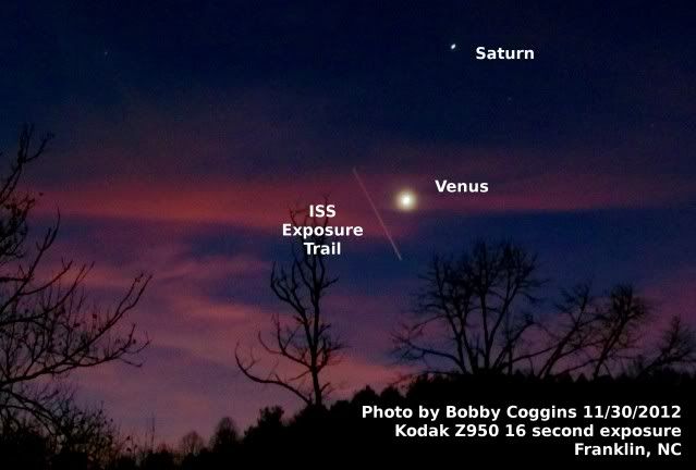
Heavens Above has an Android App that will assist you in observing the sky and even has a satellite tracker that will let you know when the International Space Station and dozens of other satellites are overhead. [LINK]
Stellarium is also an app that will assist you in observing the sky. It is available in both Android [LINK] and iOS versions. [LINK]
CROWD FUNDING OR DAY SPONSORSHIP OPPORTUNITIES
If you receive value from what Macon Media provides to the community, please consider becoming a supporter and contribute at least a dollar a month.
If you have a business or event you are interested in sponsorship opportunities or underwriting coverage, send an email to editor@MaconMedia.com for more information. Serious inquiries only. Macon Media rewards early sponsors/underwriters with lifetime guaranteed low rates while newer sponsors/underwriters pay higher rates based on the date they first support Macon Media.
Thank You to the people who have been sending in donations and those businesses who are underwriting coverage of news and events. You have kept Macon Media online. You have made it possible for Macon Media to begin purchasing state of the art equipment and begin work on building a real website with features not employed by any local news outlets.
You can find out more information on how to do that and some of what I plan to accomplish if I reach certain levels of funding at https://www.patreon.com/MaconMedia
Posted at 3:55 am on March 24, 2018
#WNCscan #MaconWx #MaconSafety
Data and information sources: Sources (except where otherwise credited): heavens-above.com, Ian Webster's Github, National Centers for Environmental Prediction, The National Weather Service, National Oceanic Atmospheric Administration, Penn State University Electronic Wall Map, The State Climate Office of North Carolina, Storm Prediction Center, U.S. Naval Observatory, and the Weather Prediction Center.


 On Thursday, May 23, 2019, SpaceX launched 60 satellites for their Starlink internet system and the small satellites have been putting on a show for people on the ground as they slowly separate and make their way to their final positions in orbit over the next few weeks.







 Posts
Posts


