Notice

I am working on the template of this blog today in order to chase down some problems that have developed with my template and widgets.

Macon County Commissioners

Coverage of the meetings of the Macon County Board of County Commissioners.

Franklin Town Board of Aldermen

Coverage of the meetings of the Franklin Town Board of Aldermen.

Macon County School Board

Coverage of the meetings of the Macon County School Board.

Photoblog

Photos from my photoblog.

nullspace for future use

nullspace for future use

About

Showing posts with label September 2020 Weather. Show all posts

Wednesday, September 30, 2020

Weather Briefing for Wednesday, September 30, 2020


OUTLOOK

Weak high pressure crosses the area today bringing seasonably cool conditions. Then a strong, but dry, cold front will cross our region on Thursday dropping temperatures to well below normal. Expect the coolest night to be Friday night, followed by a slight warming trend, as our weather stays somewhat cool into next week.


---BEGIN SPONSOR SEGMENT---


Weather Sponsor


Adams Products, a Division of Oldcastle is underwriting the daily weather briefing & public safety updates for the month.

Open 7:30 AM to 4:00 PM, M-F, located at 895 Hickory Knoll Road, Franklin, NC. Visit our Facebook page at: https://www.facebook.com/Adams.Oldcastle.Franklin.NC/

All your masonry needs are available. Our phone number is 828.524.8545, the public is welcome, we’ll help you with your next project.


--- END SPONSOR SEGMENT---


News Brief

County Commissioners Select New County Attorney

Afte a closed meeting lasting almost an hour and a half, the Macon County Board of Commissioners returned to open session and voted 3-2 (Higdon and Gillespie voting no) to instruct Derek Roland (the county manager) to enter into negotiations with Fred Jones to replace the retiring Chester Jones as new County Attorney after October 31st. Macon Media and The Franklin Press were the only media outlets present in the boadroom. Videos are posted below. A more complete article and edited video will be published later.


Part 1 (Before the closed session)


Part 2 (After the closed session)


September 28, 2020 Macon County Boad of Education Meeting


General forecast through Friday night


Today

Patchy fog before 9am. Otherwise, sunny, with highs in the 60s. Calm winds in the morning increasing to come out of the northwest around 5 mph in the afternoon.

Tonight

Clear, with lows in the 40s. A few locations may dip into the upper 30s. Calm winds.

Thursday

Sunny, with highs ranging from the low-to-mid 60s in the higher elevations to the low-to-mid 70s in the lower elevations. Calm winds in the morning increasing to come out of the northwest around 5 mph in the afternoon.

Thursday Night

Clear, with lows in the mid-to-upper 30s in the higher elevations to the low-to-mid 40s in the lower elevations. Wind chill values will be below freezing in the higher elevations and in the upper 30s elsewhere. Winds out of the northwest 5 to 10 mph. Winds could gust as high as 20 mph.

Friday

Sunny, with highs ranging from the upper 50s in the higher elevations in the higher elevations to the mid-60s in the lower elevations. Calm winds in the morning increasing to come out of the northwest around 5 mph in the afternoon.

Friday Night

Clear, with lows in the 30s. Some locations in the higher elevations may dip below freezing.


HAZARDS

Hazardous weather is not expected today. If you have outdoor plants that are sensitive to colder temperatures, you may want to consider covering them or moving them indoors Thursday and Friday night.

Air Quality


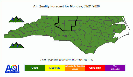
Air quality is in the upper range of green for most of the county, including the ridges and other higher elevations today.

Pollen

Pollen levels are expected to be in the low-medium range (4.7 out of 12) with ragweed, chenopods, and grasses being the main culprits. Tomorrow is expected to be very low-medium due to rain (4.6 out of 12).


TROPICAL WEATHER
(The North Atlantic Hurricane Season runs from June 1st to Nov 30th)


span style="font-family: inherit; font-size: medium;">

Tropical Weather Outlook
NWS National Hurricane Center Miami FL
200 AM EDT Wed Sep 30 2020

For the North Atlantic...Caribbean Sea and the Gulf of Mexico:

1. A tropical wave located over the central Caribbean Sea is expected to move westward to west-northwestward over the next few days and interact with a frontal system, producing a broad area of low pressure over the western Caribbean Sea by Thursday night or Friday. Environmental conditions are forecast to be conducive for some development thereafter, and a tropical depression could form over the weekend while the system moves slowly west-northwestward over the northwestern Caribbean Sea.

* Formation chance through 48 hours...low...10 percent.
* Formation chance through 5 days...medium...60 percent.


CROWDFUNDING OR DAY SPONSORSHIP OPPORTUNITIES


If you receive value from what Macon Media provides to the community, please consider becoming a supporter and contribute at least a dollar a month. Those who support Macon Media with at least a dollar a month receive early access to video of some events and meetings before they are made public on the website. Videos and news involving public safety are not subject to early access.


Become a Patron!


Or, if you prefer Pay Pal, try PayPal.me/MaconMedia


Published at 5:10am Wednesday, September 30, 2020


Tuesday, September 29, 2020

Weather Briefing for Tuesday, September 29, 2020
Includes Video of September 2020 School Board Meeting


OUTLOOK

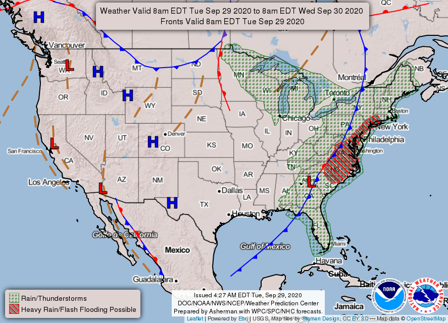
Warm and fairly humid conditions will persist early this week, with rain chances increasing gradually until a cold front pushes through Tuesday. Dry and somewhat chilly weather is expected behind the front for the second half of the week. Expecting the coolest nights to be Friday night and Saturday night.


---BEGIN SPONSOR SEGMENT---


DAY SPONSOR

Macon Media is being underwritten today by Franklin Health & Fitness, home of #ResultsForEveryone.

To see updates related to COVID-19, please click: franklinhealthandfitness.com

There are also On-Demand Fitness Videos located at https://franklinhealthandfitness.com/blog/


Weather Sponsor


Adams Products, a Division of Oldcastle is underwriting the daily weather briefing & public safety updates for the month.

Open 7:30 AM to 4:00 PM, M-F, located at 895 Hickory Knoll Road, Franklin, NC. Visit our Facebook page at: https://www.facebook.com/Adams.Oldcastle.Franklin.NC/

All your masonry needs are available. Our phone number is 828.524.8545, the public is welcome, we’ll help you with your next project.


--- END SPONSOR SEGMENT---


News Brief

School Board Votes to Resume In-Person Instruction 4 Days a Week at 5 Schools

At the recommendation of Superintendent Dr. Chris Baldwin and on a motion made by Fred Goldsmith and seconded by Tommy Cabe, the Board approved by a 5-0 vote for South Macon Elementary School, East Franklin Elementary School, Cartoogechaye Elementary School and Iotla Valley Elementary School as well as Mountain View Intermediate 5th grade to begin Plan A on Monday, October 5, 2020. Students at these schools will attend school Monday through Thursday. Fridays will remain a remote learning day.

Franklin High School, Macon Middle School, Union Academy, Macon Early College and Mountain View Intermediate School 6th grade will remain in Plan B.

September 28, 2020 Macon County Boad of Education Meeting


General forecast through Thursday night


Today

Patchy fog until late in the morning. Occasional showers and possibly a thunderstorm. Highs ranging from the late 50s in the higher elevations to the low-to-mid 60s in the lower elevations. WInds out of the northwest 5 to 10 mph. Chance of precipitation is 90%. New precipitation amounts between a quarter and half of an inch possible.

Tonight

Scattered showers, mainly before 10pm. Cloudy, then gradually becoming partly cloudy, with lows in the 40s. A few locations in the higher elevations may drop into the upper 30s. WInds out of the northwest 5 to 10 mph. Chance of precipitation is 30%. New precipitation amounts of less than a tenth of an inch possible.

Wednesday

Patchy fog before 9am. Otherwise, sunny, with highs in the 60s. Calm winds in the morning increasing to come out of the northwest around 5 mph in the afternoon.

Wednesday Night

Clear, with lows in the 40s. Calm winds.

Thursday

Sunny, with highs ranging from the mid-60s in the higher elevations to the mid-70s in the lower elevations.

Thursday Night

Mostly clear, with lows ranging from the upper 30s in the higher elevations to the low-to-mid 40s in the lower elevations.


HAZARDS

A slow-moving cold front will continue to produce periods of heavy rain through this afternoon. Isolated nuisance flooding is possible, especially across the southern North Carolina mountains.

Air Quality


Air quality is in the upper range of green for most of the county, including the ridges and other higher elevations today.

Pollen

Pollen levels are expected to be very low today (0.6 out of 12) with ragweed, chenopods, and grasses being the main culprits. Tomorrow is expected to be very low-medium due to rain (4.8 out of 12).


TROPICAL WEATHER
(The North Atlantic Hurricane Season runs from June 1st to Nov 30th)


Tropical Weather Outlook
NWS National Hurricane Center Miami FL
200 AM EDT Tue Sep 29 2020

For the North Atlantic...Caribbean Sea and the Gulf of Mexico:

1. A broad area of low pressure is expected to form over the western Caribbean Sea in a few days. Environmental conditions are forecast to be conducive for some development thereafter, and a tropical depression could form late this week or this weekend while the system moves slowly west-northwestward over the northwestern Caribbean Sea.

* Formation chance through 48 hours...low...near 0 percent.
* Formation chance through 5 days...medium...50 percent.


CROWDFUNDING OR DAY SPONSORSHIP OPPORTUNITIES


If you receive value from what Macon Media provides to the community, please consider becoming a supporter and contribute at least a dollar a month. Those who support Macon Media with at least a dollar a month receive early access to video of some events and meetings before they are made public on the website. Videos and news involving public safety are not subject to early access.


Become a Patron!


Or, if you prefer Pay Pal, try PayPal.me/MaconMedia


Published at 5:00am Monday, September 29, 2020


Monday, September 28, 2020

Weather Briefing for Monday, September 28, 2020


OUTLOOK

Warm and fairly humid conditions will persist early this week, with rain chances increasing gradually until a cold front pushes through Tuesday. Dry and somewhat chilly weather is expected behind the front for the second half of the week. Expecting the coolest nights to be Friday night and Saturday night.


---BEGIN SPONSOR SEGMENT---


DAY SPONSOR

Carrion Tree Service is underwriting Macon Media for today. they are a fully licensed and insured tree service, specializing in dangerous tree removal, view clearing, pruning, and crane services with a 24 Hour emergency response.

Their phone number is 371-4718.

They can handle all your tree removal needs in good or bad weather.


Weather Sponsor


Adams Products, a Division of Oldcastle is underwriting the daily weather briefing & public safety updates for the month.

Open 7:30 AM to 4:00 PM, M-F, located at 895 Hickory Knoll Road, Franklin, NC. Visit our Facebook page at: https://www.facebook.com/Adams.Oldcastle.Franklin.NC/

All your masonry needs are available. Our phone number is 828.524.8545, the public is welcome, we’ll help you with your next project.


--- END SPONSOR SEGMENT---


General forecast through Sunday night


Today

Scattered showers, with thunderstorms also possible after 4pm. Mostly sunny, with highs ranging from the mid-to-upper 60s in the higher elevations to the mid-70s in the lower elevations. WInds out of the south 5 to 10 mph. Chance of precipitation is 30%. New rainfall amounts of less than a tenth of an inch, except higher amounts possible in thunderstorms.

Tonight

A chance of showers and thunderstorms, then showers likely and possibly a thunderstorm after 9pm. Patchy fog after midnight. Otherwise, increasing clouds, with lows in the 50s. Light and variable winds. Chance of precipitation is 70%. New rainfall amounts between a quarter and half of an inch possible.

Tuesday

Patchy fog in the morning.Highs in the 60s. Calm winds in the morning increasing to come out of the northwest around 5 mph in the afternoon. Chance of precipitation is 80%. New precipitation amounts between a half and three-quarters of an inch possible.

Tuesday Night

Showers likely, mainly before 7pm. Mostly cloudy, with lows in the 40s. Light winds out of the northwest. Chance of precipitation is 60%.

Wednesday

A 20 percent chance of showers. Mostly sunny, with highs in the 60s.

Wednesday Night

Partly cloudy, with a low around 48.


HAZARDS

Hazardous weather is not expected at this time.

Air Quality


Air quality is in the upper range of green for most of the county, including the ridges and other higher elevations today.

Pollen

Pollen levels are expected to be low today (3.5 out of 12) with ragweed, chenopods, and grasses being the main culprits. Tomorrow is expected to be very low due to rain (0.6 out of 12).


TROPICAL WEATHER
(The North Atlantic Hurricane Season runs from June 1st to Nov 30th)


Tropical Weather Outlook
NWS National Hurricane Center Miami FL
200 AM EDT Mon Sep 28 2020

For the North Atlantic...Caribbean Sea and the Gulf of Mexico:

1. A broad area of low pressure could form over the western Caribbean Sea in a few days. Thereafter, some gradual development is possible late this week while the system moves slowly west-northwestward over the northwestern Caribbean.

* Formation chance through 48 hours...low...near 0 percent. * Formation chance through 5 days...low...20 percent.


CROWDFUNDING OR DAY SPONSORSHIP OPPORTUNITIES


If you receive value from what Macon Media provides to the community, please consider becoming a supporter and contribute at least a dollar a month. Those who support Macon Media with at least a dollar a month receive early access to video of some events and meetings before they are made public on the website. Videos and news involving public safety are not subject to early access.


Become a Patron!


Or, if you prefer Pay Pal, try PayPal.me/MaconMedia


Published at 3:20am Monday, September 28, 2020


Friday, September 25, 2020

Weather Briefing for Friday, September 25, 2020


OUTLOOK

Widespread rain is expected today as the remnants of tropical system Beta move across the area. A mainly dry weekend is expected before unsettled weather returns with a cold front next week.


---BEGIN SPONSOR SEGMENT---


Weather Sponsor


Adams Products, a Division of Oldcastle is underwriting the daily weather briefing & public safety updates for the month.

Open 7:30 AM to 4:00 PM, M-F, located at 895 Hickory Knoll Road, Franklin, NC. Visit our Facebook page at: https://www.facebook.com/Adams.Oldcastle.Franklin.NC/

All your masonry needs are available. Our phone number is 828.524.8545, the public is welcome, we’ll help you with your next project.


--- END SPONSOR SEGMENT---


News Brief

See the COVID-19 Update from yesterday afternnon. [LINK]

Franklin High School to Begin In-Person Instruction Two Days a Week Beginning Sept 28th

Franklin High School is excited to announce that beginning Monday, 9/28, we will welcome students to campus 2 days per week on the following rotation.
Monday/Wednesday - 9th Grade and 11th Grade
Tuesday/Thursday - 10th Grade and 12th Grade
Friday - Remote learning for all grades.
Please remember that on Fridays, extra help is available for students. Please email the teacher to make an appointment to come in.


General forecast through Sunday night


Today

Patchy fog possible through late morning. Showers before 11am, then showers likely and possibly a thunderstorm between 11am and 4pm, then a chance of showers and thunderstorms after 4pm. Highs ranging from the lower 60s in the higher elevations to the lower 70s in the lower elevations. Calm winds in the morning increasing to come out of the south around 5 mph in the afternoon. Chance of precipitation is 80%. New rainfall amounts between a tenth and quarter of an inch, except higher amounts possible in thunderstorms.

Tonight

A chance of showers and thunderstorms before 8pm, then a slight chance of showers between 8pm and midnight. Patchy fog after 9pm. Otherwise, mostly cloudy, with lows mostly in the 50s. Calm winds. Chance of precipitation is 30%. New precipitation amounts of less than a tenth of an inch, except higher amounts possible in thunderstorms.

Saturday

Patchy fog before 9am. Otherwise, partly sunny, with highs ranging from the upper 60s in the higher elevations to the upper 70s in the lowerelevations. Calm winds.

Saturday Night

Partly cloudy, with lows in the 50s. Calm winds.

Sunday

A 20 percent chance of showers after 3pm. Partly sunny, with highs ranging from the upper 60s in the higher elevations to the upper 70s in the lower elevations.

Sunday Night

Mostly cloudy, with lows in the 50s.


HAZARDS

Hazardous weather is not expected at this time.

Air Quality


Air quality is in the tower range of green for most of the county and in the lower range of green on the ridges and other higher elevations today.

Pollen

Pollen levels are expected to be very low today (0.7 out of 12) with ragweed, chenopods, and grasses being the main culprits. Tomorrow is expected to be in the low-medium range (4.3 out of 12).


TROPICAL WEATHER
(The North Atlantic Hurricane Season runs from June 1st to Nov 30th)


Tropical Weather Outlook
NWS National Hurricane Center Miami FL
200 AM EDT Fri Sep 25 2020

For the North Atlantic...Caribbean Sea and the Gulf of Mexico:

The Weather Prediction Center is issuing advisories on Post-Tropical Cyclone Beta, centered inland over northern Alabama.

Tropical cyclone formation is not expected during the next 5 days.


CROWDFUNDING OR DAY SPONSORSHIP OPPORTUNITIES


If you receive value from what Macon Media provides to the community, please consider becoming a supporter and contribute at least a dollar a month. Those who support Macon Media with at least a dollar a month receive early access to video of some events and meetings before they are made public on the website. Videos and news involving public safety are not subject to early access.


Become a Patron!


Or, if you prefer Pay Pal, try PayPal.me/MaconMedia


Published at 5:10am Friday, September 25, 2020


Thursday, September 24, 2020

Weather Briefing for Thursday, September 24, 2020


OUTLOOK

Rain chances increase today into Friday as the remnants of tropical system Beta move across the area. A mainly dry weekend is expected before unsettled weather returns with a cold front next week.


DAY SPONSOR

Macon Media is being underwritten today by Franklin Health & Fitness, home of #ResultsForEveryone.

To see updates related to COVID-19, please click: franklinhealthandfitness.com

There are also On-Demand Fitness Videos located at https://franklinhealthandfitness.com/blog/


Weather Sponsor


Adams Products, a Division of Oldcastle is underwriting the daily weather briefing & public safety updates for the month.

Open 7:30 AM to 4:00 PM, M-F, located at 895 Hickory Knoll Road, Franklin, NC. Visit our Facebook page at: https://www.facebook.com/Adams.Oldcastle.Franklin.NC/

All your masonry needs are available. Our phone number is 828.524.8545, the public is welcome, we’ll help you with your next project.


---END SPONSOR SEGMENT---


News Brief

See the COVID-19 UPdate from yesterday afternnon. [LINK]

Franklin High School to Begin In-Person Instruction Two Days a Week Beginning Sept 28th

Franklin High School is excited to announce that beginning Monday, 9/28, we will welcome students to campus 2 days per week on the following rotation.
Monday/Wednesday - 9th Grade and 11th Grade
Tuesday/Thursday - 10th Grade and 12th Grade
Friday - Remote learning for all grades.
Please remember that on Fridays, extra help is available for students. Please email the teacher to make an appointment to come in.


General forecast through Saturday night


Today

Patchy fog in the morning. Rain likely. Otherwise, cloudy, with highs in the 60s. Calm winds. Chance of precipitation is near 100%. New precipitation amounts between a tenth and quarter of an inch possible.

Tonight

Showers. The rain could be heavy at times. Patchy fog before 2am. Lows in the 50s. Calm winds. Chance of precipitation is 90%. New precipitation amounts between three quarters and one inch possible.

Friday

Showers before 11am, then showers likely and possibly a thunderstorm between 11am and 2pm, then a chance of showers and thunderstorms after 2pm. Highs ranging from the upper 60s in the higher elevations to the mid-70s in the lower elevations. Calm winds in the morning increasing to come out of the southwest around 5 mph in the afternoon. Chance of precipitation is 80%. New rainfall amounts between a tenth and quarter of an inch, except higher amounts possible in thunderstorms.

Friday Night

A chance of showers and thunderstorms. Mostly cloudy, with lows in the 50s. Calm winds. Chance of precipitation is 30%.

Saturday

A 20 percent chance of showers before 2pm. Partly sunny, with highs in the 70s.

Saturday Night

Partly cloudy, with lows mostly in the 50s. Some locations in the lower elevations might stay above 60.


HAZARDS

Hazardous weather is not expected at this time.

Air Quality


Air quality is in the upper range of green for most of the county and in the mid-range of yellow on the ridges and other higher elevations today.

Pollen

Pollen levels are expected to be very low today (0.6 out of 12) with ragweed, chenopods, and grasses being the main culprits. Tomorrow is expected to be about the same due to frequent rain showers (0.7 out of 12).


TROPICAL WEATHER
(The North Atlantic Hurricane Season runs from June 1st to Nov 30th)


Tropical Weather Outlook
NWS National Hurricane Center Miami FL
200 AM EDT Thu Sep 24 2020

For the North Atlantic...Caribbean Sea and the Gulf of Mexico:

The National Hurricane Center has issued the final advisory on Post-Tropical Cyclone Teddy, located near southeastern Labrador, Canada. The Weather Prediction Center is issuing advisories on Post-Tropical Cyclone Beta, located inland near the Louisiana/ Mississippi border.

Tropical cyclone formation is not expected during the next 5 days.


CROWDFUNDING OR DAY SPONSORSHIP OPPORTUNITIES


If you receive value from what Macon Media provides to the community, please consider becoming a supporter and contribute at least a dollar a month. Those who support Macon Media with at least a dollar a month receive early access to video of some events and meetings before they are made public on the website. Videos and news involving public safety are not subject to early access.


Become a Patron!


Or, if you prefer Pay Pal, try PayPal.me/MaconMedia


Published at 5:00am Thursday, September 24, 2020


Wednesday, September 23, 2020

Weather Briefing for Wednesday, September 23, 2020


OUTLOOK

High pressure over the area moves east today. Clouds from the remnants of Beta will begin to fill today with rain chances increasing Thursday into Friday. An unsettled weather pattern is expected this weekend through the middle of next week.


Weather Sponsor


Adams Products, a Division of Oldcastle is underwriting the daily weather briefing & public safety updates for the month.

Open 7:30 AM to 4:00 PM, M-F, located at 895 Hickory Knoll Road, Franklin, NC. Visit our Facebook page at: https://www.facebook.com/Adams.Oldcastle.Franklin.NC/

All your masonry needs are available. Our phone number is 828.524.8545, the public is welcome, we’ll help you with your next project.


---END SPONSOR SEGMENT---


News Brief

See the COVID-19 UPdate from yesterday afternnon. [LINK]

Franklin High School to Begin In-Person Instruction Two Days a Week Beginning Sept 28th

Franklin High School is excited to announce that beginning Monday, 9/28, we will welcome students to campus 2 days per week on the following rotation.
Monday/Wednesday - 9th Grade and 11th Grade
Tuesday/Thursday - 10th Grade and 12th Grade
Friday - Remote learning for all grades.
Please remember that on Fridays, extra help is available for students. Please email the teacher to make an appointment to come in.

Dr.John Campbell: Follow the science and evidence
(video published on the afternoon of Tuesday, September 22, 2020)


US-64 road closure next week between Buck Creek Rd and Brush Creek Dr [LINK]

Another COVID-19 Case Identified at Cartoogechaye School

Press Release, Monday, Sept 21st at 8:44am

Today we were notified that a positive case of COVID-19 has been confirmed at Cartoogechaye Elementary School. This individual is currently under quarantine. Contact tracing is underway through the Macon County Health Department. Any student or staff member identified through the contact tracing will be notified. Macon County Schools will continue to work closely with the Macon County Health Department as we monitor this situation.


General forecast through Friday night


Today

Areas of fog before 9am. Otherwise, mostly cloudy, with highs ranging from the low-to-mid 60s in the higher elevations to the lowe 70s in the lower 70s. Calm winds.

Tonight

A 20 percent chance of showers after 10pm. Mostly cloudy, with lows in the 50s. Calm winds.

Thursday

Showers likely, mainly after 2pm. Cloudy, with highs ranging from the upper 50s in the higher elevations to the mid-60s in the lower elevations. Calm winds in the morning increasing to come out of the west around 5 mph in the afternoon. Chance of precipitation is 60%. New precipitation amounts between a tenth and quarter of an inch possible.

Thursday Night

Showers likely. Cloudy, with lows in the 50s. Winds out of the east 5 to 10 mph. Chance of precipitation is 70%. New precipitation amounts between a half and three-quarters of an inch possible.

Friday

Showers likely, with thunderstorms also possible after 2pm. Mostly cloudy, with highs ranging from near 60 in the higher elevations to near 70 in the lower elevations. Light and variable winds. Chance of precipitation is 70%.

Friday Night

A 30 percent chance of showers, mainly before 9pm. Mostly cloudy, with lows in the 50s in the higher elevations and near 60 in the lower elevations.


HAZARDS

Hazardous weather is not expected at this time.

Air Quality


Air quality is in the upper range of green for most of the county and in the mid-range of yellow on the ridges and other higher elevations today.

Pollen

Pollen levels are expected to be medium today (5.9 out of 12) with ragweed, chenopods, and grasses being the main culprits. Tomorrow is expected to be a much lower (1.2 out of 12).


TROPICAL WEATHER
(The North Atlantic Hurricane Season runs from June 1st to Nov 30th)


Tropical Weather Outlook
NWS National Hurricane Center Miami FL
200 AM EDT Wed Sep 23 2020

For the North Atlantic...Caribbean Sea and the Gulf of Mexico:

The National Hurricane Center is issuing advisories on Post-Tropical Cyclone Teddy, located about 125 miles south of Halifax, Nova Scotia, and has issued the last advisory on Post-Tropical Cyclone Paulette, located several hundred miles east-southeast of the Azores. The Weather Prediction Center is issuing advisories on Post-Tropical Cyclone Beta located just inland along the central Texas coast.

Tropical cyclone formation is not expected during the next 5 days.


POST-TROPICAL CYCLONE BETA


BULLETIN
Post-Tropical Cyclone Beta Advisory Number 22
NWS Weather Prediction Center College Park MD AL222020
1000 PM CDT Tue Sep 22 2020

...BETA STARTING TO MOVE EAST AND CONTINUES TO BE A HEAVY RAINFALL AND FLOODING THREAT OVER PORTIONS OF THE UPPER TEXAS COAST INTO THE LOWER MISSISSIPPI RIVER VALLEY...


SUMMARY OF 1000 PM CDT...0300 UTC...INFORMATION
----------------------------------------------- LOCATION...29.1N 95.4W
ABOUT 40 MI...60 KM WSW OF GALVESTON TEXAS
ABOUT 50 MI...80 KM NE OF MATAGORDA TEXAS
MAXIMUM SUSTAINED WINDS...30 MPH...45 KM/H
PRESENT MOVEMENT...NE OR 55 DEGREES AT 8 MPH...13 KM/H
MINIMUM CENTRAL PRESSURE...1007 MB...29.74 INCHES


WATCHES AND WARNINGS
--------------------
There are Flash Flood Watches currently in effect across Southeast
Texas and Southern Louisiana.


DISCUSSION AND OUTLOOK
----------------------
At 1000 PM CDT (0300 UTC), the center of Post-Tropical Cyclone Beta was located near latitude 29.1 North, longitude 95.4 West. The post-tropical cyclone is moving toward the northeast near 8 mph (13 km/h) and this motion is expected to continue through the next 48 hours.

Maximum sustained winds are near 30 mph (45 km/h) with higher gusts. Little change in strength or slow weakening is forecast during the next 48 hours.

The estimated minimum central pressure is 1007 mb (29.74 inches).


HAZARDS AFFECTING LAND
----------------------
RAINFALL: For the upper Texas coast, additional rainfall of 4 to 8 inches with isolated storm totals up to 20 inches is expected. Significant flash and urban flooding is occurring and will continue overnight . Minor to isolated moderate river flooding is ongoing.

Rainfall totals of 13 to 14 inches have been measured across portions of the Houston metropolitan area thus far.

Rainfall totals of 2 to 5 inches are expected east into the Lower Mississippi Valley, portions of the Tennessee Valley, and the southern Appalachians through the end of the week. Flash and urban flooding is possible, as well as isolated minor river flooding on smaller rivers.

SURF: Swells generated by a combination of Beta and a cold front over the northern Gulf of Mexico will continue along the coasts of Louisiana and Texas during the next couple of days. These swells are likely to cause life-threatening surf and rip current conditions. Information on ongoing coastal flooding can be found in coastal flood products issued by local National Weather Service offices.


CROWDFUNDING OR DAY SPONSORSHIP OPPORTUNITIES


If you receive value from what Macon Media provides to the community, please consider becoming a supporter and contribute at least a dollar a month. Those who support Macon Media with at least a dollar a month receive early access to video of some events and meetings before they are made public on the website. Videos and news involving public safety are not subject to early access.


Become a Patron!


Or, if you prefer Pay Pal, try PayPal.me/MaconMedia


Published at 5:00am Wednesday, September 23, 2020


Tuesday, September 22, 2020

Weather Briefing for Tuesday, September 22, 2020


OUTLOOK

Cool and dry high pressure will continue to build south over the region today. The high will then weaken and shift south and east, allowing temperatures to gradually warm to near normal by the end of the week. Rain chances will be on the increase as well late in the week.


Weather Sponsor


Adams Products, a Division of Oldcastle is underwriting the daily weather briefing & public safety updates for the month.

Open 7:30 AM to 4:00 PM, M-F, located at 895 Hickory Knoll Road, Franklin, NC. Visit our Facebook page at: https://www.facebook.com/Adams.Oldcastle.Franklin.NC/

All your masonry needs are available. Our phone number is 828.524.8545, the public is welcome, we’ll help you with your next project.


---END SPONSOR SEGMENT---


News Brief

US-64 road closure next week between Buck Creek Rd and Brush Creek Dr [LINK]

Another COVID-19 Case Identified at Cartoogechaye School

Press Release, Monday, Sept 21st at 8:44am

Today we were notified that a positive case of COVID-19 has been confirmed at Cartoogechaye Elementary School. This individual is currently under quarantine. Contact tracing is underway through the Macon County Health Department. Any student or staff member identified through the contact tracing will be notified. Macon County Schools will continue to work closely with the Macon County Health Department as we monitor this situation.


General forecast through Thursday night


Today

Widespread fog, mainly before 10am. Otherwise, sunny, with highs ranging from the mid-60s in the higher elevations to the mid-70s in the lower elevations. Calm winds.

Tuesday Night

Mostly cloudy, with lows mostly in the 40s to near 50 in the lower elevations. Calm winds.

Wednesday

Mostly cloudy, with highs ranging from the mid-60s in the higher elevations to the mid-70s in the lower elevations. Calm winds.

Wednesday Night

Mostly cloudy, with lows in the 50s. Calm winds.

Thursday

A 30 percent chance of showers, mainly after 2pm. Cloudy, with highs in the 60s to ner 70 in the lower elevations.

Thursday Night

A chance of showers and thunderstorms before 11pm, then showers likely and possibly a thunderstorm between 11pm and 3am, then showers likely after 3am. Cloudy, with lows in the 50s. Chance of precipitation is 60%.


HAZARDS

Hazardous weather is not expected at this time.

Air Quality


Air quality is in the upper range of green today as ozone and particulate matter levels are exptected to not be a problem today.

Pollen

Pollen levels are expected to be medium today (6.6 out of 12) with ragweed, chenopods, and grasses being the main culprits. Tomorrow is expected to be a little lower (6.1 out of 12).


TROPICAL WEATHER
(The North Atlantic Hurricane Season runs from June 1st to Nov 30th)


Tropical Tidbit from Levi Cowan (video recoded yesterday afternoon)


Tropical Weather Outlook
NWS National Hurricane Center Miami FL
200 AM EDT Tue Sep 22 2020

For the North Atlantic...Caribbean Sea and the Gulf of Mexico:

The National Hurricane Center is issuing advisories on Tropical Storm Beta, located over the Texas coast, on Hurricane Teddy, located about 600 miles south of Halifax, Nova Scotia, and has re-initiated advisories on regenerated Tropical Storm Paulette, located about 300 miles south-southeast of the Azores.

1. Showers and thunderstorms extending from the Bahamas westward through the Straits of Florida and into the southeastern Gulf of Mexico are associated with a frontal system. This system is forecast to move slowly southward over Cuba during the next couple of days, and then move back northward on Thursday through Saturday. Environmental conditions could be marginally conducive for some slight development over the southeastern Gulf of Mexico late this week. Regardless of development, locally heavy rainfall is possible over portions of Cuba on Tuesday and Wednesday.

* Formation chance through 48 hours...low...near 0 percent. * Formation chance through 5 days...low...10 percent.


TROPICAL STOM BETA


Tropical Storm Beta Discussion Number 18
NWS National Hurricane Center Miami FL AL222020
1000 PM CDT Mon Sep 21 2020

There has been a recent increase in convection along the Texas coast just to the north of Beta's center this evening. A blend of flight-level and SFMR winds from an Air Force Reserve reconnaissance aircraft indicate that Beta's peak intensity remains around 40 kt. The aircraft has reported a minimum central pressure of around 999 mb, which is unchanged from earlier today. West-southwesterly vertical wind shear and land interaction should gradually weaken the cyclone over the next couple of days. The NHC intensity forecast is a little above model guidance through 24 hours since a significant portion of the circulation is forecast to remain over water. Strong vertical wind shear is expected to prevent re-strengthening when Beta moves near or just offshore of the Upper Texas coast in a couple of days.

Beta is moving northwestward or 325/3 kt. The tropical storm should move just inland along the central Texas coast overnight, but it is expected to become nearly stationary on Tuesday as steering currents collapse. A weak trough over the south-central United States should begin to steer Beta east-northeastward Tuesday night and Wednesday, and a northeastward motion at a slightly faster forward speed should continue until dissipation in 72-96 hours. The latest NHC track forecast is very similar to the previous advisory and is a blend of the latest GFS and ECMWF models.

Key Messages:

1. The expected slow motion of Beta will produce a long duration rainfall event from the middle Texas coast to southeast Louisiana. Flash, urban, and minor river flooding is likely. Rainfall will also spread northward into the ArkLaTex region and east into the Lower Mississippi Valley and portions of the Southeast through the end of the week. Flash, urban, and isolated minor river flooding is possible.

2. There is the danger of life-threatening storm surge near times of high tide through Tuesday along portions of the Texas and Louisiana coasts within the storm surge warning areas. Residents in these areas should follow advice given by local officials.

3. Tropical-storm-force winds will spread westward across the Texas coast through Tuesday.


FORECAST POSITIONS AND MAX WINDS

INIT 22/0300Z 28.4N 96.3W 40 KT 45 MPH 12H 22/1200Z 28.6N 96.3W 35 KT 40 MPH...INLAND
24H 23/0000Z 28.8N 96.0W 35 KT 40 MPH...INLAND
36H 23/1200Z 29.1N 95.0W 30 KT 35 MPH...OVER WATER
48H 24/0000Z 29.5N 93.8W 30 KT 35 MPH...OVER WATER
60H 24/1200Z 30.4N 92.3W 25 KT 30 MPH...INLAND
72H 25/0000Z 31.7N 90.7W 20 KT 25 MPH...POST-TROP/REMNT LOW
96H 26/0000Z...DISSIPATED


CROWDFUNDING OR DAY SPONSORSHIP OPPORTUNITIES


If you receive value from what Macon Media provides to the community, please consider becoming a supporter and contribute at least a dollar a month. Those who support Macon Media with at least a dollar a month receive early access to video of some events and meetings before they are made public on the website. Videos and news involving public safety are not subject to early access.


Become a Patron!


Or, if you prefer Pay Pal, try PayPal.me/MaconMedia


Published at 2:45am Tuesday, September 22, 2020


Monday, September 21, 2020

Weather Briefing for Monday, September 21, 2020


OUTLOOK

Cool and dry high pressure will continue to build south over the region through Tuesday. The high will then weaken and shift south and east, allowing temperatures to gradually warm to near normal by the end of the week. Rain chances will be on the increase as well late in the week.


---BEGIN SPONSOR SEGMENT ---


DAY SPONSOR

Carrion Tree Service is underwriting Macon Media for today. they are a fully licensed and insured tree service, specializing in dangerous tree removal, view clearing, pruning, and crane services with a 24 Hour emergency response.

Their phone number is 371-4718.

They can handle all your tree removal needs in good or bad weather.


Weather Sponsor


Adams Products, a Division of Oldcastle is underwriting the daily weather briefing & public safety updates for the month.

Open 7:30 AM to 4:00 PM, M-F, located at 895 Hickory Knoll Road, Franklin, NC. Visit our Facebook page at: https://www.facebook.com/Adams.Oldcastle.Franklin.NC/

All your masonry needs are available. Our phone number is 828.524.8545, the public is welcome, we’ll help you with your next project.


---END SPONSOR SEGMENT---


News Brief

Supreme Court Associate Justice Ruth BaderGinsburg has died. The Governor has ordered US and NC Flags to emian lowered until her internment. [LINK]

General forecast through Saturday night


Today

Sunny, with highs ranging from the lower 60s in the higher elevations to the lower 70s in the lower elevations. Calm winds in the morning increasing to come out of the southeast around 5 mph in the afternoon.

Tonight

Mostly clear, with lows in the 30s to near 40 in the lower elevations. Light winds out of the southeast.

Tuesday

Mostly sunny, with highs ranging from the mid-60s in the higher elevations to the mid-70s in the lower elevations. Calm winds.

Tuesday Night

Partly cloudy, with lows in the 40s. Calm winds.

Wednesday

Partly sunny, with highs ranging from the mid-60s to the mid-70s in the lower elevations. Calm winds.

Wednesday Night

Mostly cloudy, with lows ranging from the upper 40s in the lower elevations to the mid-50s in the lower elevations.


HAZARDS

Hazardous weather is not expected at this time.

Air Quality


Air quality is in the upper range of green today as ozone and particulate matter levels are exptected to not be a problem today.

Pollen

Pollen levels are expected to be medium today (6.8 out of 12) with ragweed, chenopods, and grasses being the main culprits. Tomorrow is expected to lower (6.0 out of 12).


TROPICAL WEATHER
(The North Atlantic Hurricane Season runs from June 1st to Nov 30th)


Tropical Tidbit from Levi Cowan (video recoded yesterday afternoon)


Tropical Weather Outlook
NWS National Hurricane Center Miami FL
200 AM EDT Mon Sep 21 2020

For the North Atlantic...Caribbean Sea and the Gulf of Mexico:

The National Hurricane Center is issuing advisories on Tropical Storm Beta, located over the western Gulf of Mexico, on Hurricane Teddy, located a couple of hundred miles south-southeast of Bermuda. The National Hurricane Center has issued its last advisory on the remnants of Wilfred, located over the central tropical Atlantic.

1. Post-Tropical Cyclone Paulette is producing a small area of showers and thunderstorms, not far to the southeast of its center of circulation. The system is meandering over marginally warm waters and is expected to begin moving eastward later today. Further development is possible and the system could become a tropical or subtropical cyclone today or tomorrow. For more information about marine hazards associated with this system, see High Seas Forecasts issued by Meteo France.

* Formation chance through 48 hours...medium...60 percent. * Formation chance through 5 days...medium...60 percent.


TROPICAL STOM BETA


Tropical Storm Beta Discussion Number 15
NWS National Hurricane Center Miami FL AL222020
400 AM CDT Mon Sep 21 2020

Beta is struggling this morning. Satellite images show that much of the deep convection associated with the storm has dissipated, and data from the Air Force Hurricane Hunters indicate that the winds have decreased. Based on a combination of flight-level and SFMR data from the aircraft, the initial intensity is lowered to 45 kt. This estimate is also in agreement with an ASCAT pass from a few hours ago that showed peak winds close to 40 kt. It is also worth noting that the tropical-storm-force winds are largely confined to the northern half of the circulation, and these winds should spread across the Texas coast later this morning.

Beta has been moving due westward during the past several hours, with the latest initial motion estimated to be 270/5 kt. In the short term, Beta is expected to resume a west-northwestward motion at a forward speed of about 5 kt, and that motion should take the tropical storm to the Texas coast by tonight. The models differ on how far inland Beta gets over Texas, but the majority of the guidance shows the cyclone stalling just inland on Tuesday in weak steering currents. The combination of an approaching shortwave trough and an amplifying ridge over Florida should cause Beta to turn northeastward along or near the Texas coast late Tuesday and Wednesday, and then farther inland over Louisiana on Thursday. The NHC track forecast is largely an update of the previous one and remains near the various consensus aids.

The tropical storm is certainty feeling the effects of dry and stable air that has wrapped into the circulation. The combination of the dry air mass and 15-20 kt of southwesterly wind shear should limit strengthening through landfall tonight. Steady weakening is forecast after that time due to the storm interacting with land and stronger southwesterly shear. The models are in quite good agreement, and the NHC intensity forecast lies near the high end of the guidance envelope.

Key Messages:

1. The expected slow motion of Beta will produce a long duration rainfall event from the middle Texas coast to southeast Louisiana. Flash, urban, and minor river flooding is likely. Rainfall will also spread northward into the ArkLaTex region and east into the Lower Mississippi Valley and portions of the Southeast through the end of the week. Flash, urban, and isolated minor river flooding is possible.

2. There is the danger of life-threatening storm surge near times of high tide through Tuesday along portions of the Texas and Louisiana coasts within the storm surge warning areas. Residents in these areas should follow advice given by local officials.

3. Tropical-storm-force winds will spread westward across the Texas coast later this morning and continue into Tuesday.


FORECAST POSITIONS AND MAX WINDS

INIT 21/0900Z 27.7N 95.1W 45 KT 50 MPH
12H 21/1800Z 28.0N 96.0W 45 KT 50 MPH
24H 22/0600Z 28.4N 96.6W 40 KT 45 MPH...INLAND
36H 22/1800Z 28.7N 96.5W 35 KT 40 MPH...INLAND
48H 23/0600Z 28.9N 95.8W 30 KT 35 MPH...INLAND
60H 23/1800Z 29.4N 94.7W 25 KT 30 MPH...INLAND
72H 24/0600Z 30.2N 93.2W 25 KT 30 MPH...INLAND
96H 25/0600Z 32.8N 90.5W 20 KT 25 MPH...POST-TROP/INLAND


CROWDFUNDING OR DAY SPONSORSHIP OPPORTUNITIES


If you receive value from what Macon Media provides to the community, please consider becoming a supporter and contribute at least a dollar a month. Those who support Macon Media with at least a dollar a month receive early access to video of some events and meetings before they are made public on the website. Videos and news involving public safety are not subject to early access.


Become a Patron!


Or, if you prefer Pay Pal, try PayPal.me/MaconMedia


Published at 5:00am Monday, September 21, 2020


Saturday, September 19, 2020

Weather Briefing for Saturday, September 19, 2020


OUTLOOK

High pressure will build south into the region, providing dry and cool conditions for the weekend. Dry high pressue will linger atop the region into the middle of next week as temperatures slowly moderate.


---BEGIN SPONSOR SEGMENT ---


Weather Sponsor


Adams Products, a Division of Oldcastle is underwriting the daily weather briefing & public safety updates for the month.

Open 7:30 AM to 4:00 PM, M-F, located at 895 Hickory Knoll Road, Franklin, NC. Visit our Facebook page at: https://www.facebook.com/Adams.Oldcastle.Franklin.NC/

All your masonry needs are available. Our phone number is 828.524.8545, the public is welcome, we’ll help you with your next project.


---END SPONSOR SEGMENT---


News Brief

Supreme Court Associate Justice Ruth BaderGinsburg has died. The Governor has ordered US and NC Flags to emian lowered until her internment. [LINK]

General forecast through Saturday night


Today

Patchy fog in the morning. Otherwise, cloudy, with highs in the 60s. Some locations in thelower elevations could reach 70 or 71. Calm winds in the morning increasing to come out of the northeast around 5 mph.

Saturday Night

Mostly cloudy, with lows ranging from the upper 30s in the higher elevations to the upper 40s in the lower elevations. Light and variable winds.

Sunday

Sunny, with highs ranging from the mid-60s in the higher elevations to thelower 70s in the lower elevations. Calm winds in the morning increasing to comeout of the east around 5 mph in the afternoon.

Sunday Night

Mostly clear, with lows ranging from the upper 30s in the higher elevations tothe low-to-mid 40s in the lower elevations. Light winds out of the east.

Monday

Sunny, with highs in the 60s.

Monday Night

Mostly clear, with lows ranging from the mid-30s in thehigher elevations to the lower 40s in the lower elevations.


HAZARDS

Hazardous weather is not expected at this time.

Air Quality


Air quality is in the upper range of green today as ozone and particulate matter levels are exptected to not be a problem today.

Pollen

Pollen levels are expected to be medium today (6.8 out of 12) with ragweed, chenopods, and grasses being the main culprits. Tomorrow is expected to higher (6.9 out of 12).


TROPICAL WEATHER
(The North Atlantic Hurricane Season runs from June 1st to Nov 30th)


Tropical Tidbit from Levi Cowan (video recoded yesterday afternoon)


Tropical Weather Outlook
NWS National Hurricane Center Miami FL
200 AM EDT Sat Sep 19 2020

For the North Atlantic...Caribbean Sea and the Gulf of Mexico:

The National Hurricane Center is issuing advisories on Tropical Storm Beta, located over the western Gulf of Mexico, on Hurricane Teddy, located over the central Atlantic, and on Tropical Storm Wilfred, located over the eastern tropical Atlantic. The National Hurricane Center has issued its last advisory on Alpha, which became post-tropical over northern Portugal.

1. Post-Tropical Cyclone Paulette is moving southward and is now located just south of the western Azores. The cyclone is forecast to continue southward for the next day or two and then stall over marginally warm waters a few hundred miles south of the Azores. The cyclone could subsequently develop tropical or subtropical characteristics by early next week while it moves little. For more information about marine hazards associated with this system, see High Seas Forecasts issued by Meteo France.

* Formation chance through 48 hours...medium...40 percent. * Formation chance through 5 days...medium...50 percent. 2. A tropical wave is located near the west coast of Africa and will move westward over the far eastern Atlantic during the next few days. Development of this system, if any, will be slow to occur during the next few days.

* Formation chance through 48 hours...low...near 0 percent. * Formation chance through 5 days...low...10 percent.


CROWDFUNDING OR DAY SPONSORSHIP OPPORTUNITIES


If you receive value from what Macon Media provides to the community, please consider becoming a supporter and contribute at least a dollar a month. Those who support Macon Media with at least a dollar a month receive early access to video of some events and meetings before they are made public on the website. Videos and news involving public safety are not subject to early access.


Become a Patron!


Or, if you prefer Pay Pal, try PayPal.me/MaconMedia


Published at 3:45am Saturday, September 19, 2020


Friday, September 18, 2020

Weather Briefing for Friday, September 18, 2020


OUTLOOK

Heavy rainfall and isolated thunderstorms associated with Tropical Depression Sally will impact much of the area today with showers and storms tapering off by early Friday morning. Thereafter, dry and cool high pressure will dominate the weather through the middle of next week.


---BEGIN SPONSOR SEGMENT ---


Weather Sponsor


Adams Products, a Division of Oldcastle is underwriting the daily weather briefing & public safety updates for the month.

Open 7:30 AM to 4:00 PM, M-F, located at 895 Hickory Knoll Road, Franklin, NC. Visit our Facebook page at: https://www.facebook.com/Adams.Oldcastle.Franklin.NC/

All your masonry needs are available. Our phone number is 828.524.8545, the public is welcome, we’ll help you with your next project.


---END SPONSOR SEGMENT---


News Brief

COVID-19 pdate for Wednesday, September 16, 2020 [LINK]

General forecast through Saturday night


Today

Partly sunny, with highs ranging from the upper 60s in the higher elevations to the mid-70s in the lower elevations. Calm winds early increasing to come out of the northwest 5 to 10 mph by midmorning.

Tonight

Mostly cloudy, with lows ranging from the upper 40s in the higher elevations to the mid-50sin the lower elevations. WInds out of the northwest around 5 mph becoming calm before midnight.

Saturday

Mostly cloudy, with highs ranging from the lower 60s in the higher elevations to the lower 70s in the lower elevations. Light winds out of the southeast.

Saturday Night

Mostly cloudy, with lows ranging from the upper 30s in the higher elevations to the upper 40s in the lower elevations. Calm winds.

Sunday

Sunny, with highs ranging from near 60 in the higher elevations to near 70 in the lower elevations.

Sunday Night

Mostly clear, with low ranging from the upper 30s in the higher elevations to the low-to-mid 40s in the lower elevations.


HAZARDS

Hazardous weather is not expected at this time.

Air Quality


Air quality is in the upper range of green today as ozone and particulate matter levels are exptected to not be a problem today.

Pollen

Pollen levels are expected to be medium today (6.4 out of 12) with ragwee,, chenopods, and grasses being the main culprits. Tomorrow is expected to higher (7.0 out of 12).


TROPICAL WEATHER
(The North Atlantic Hurricane Season runs from June 1st to Nov 30th)


Tropical Tidbit from Levi Cowan (video recoded yesterday afternoon)


Tropical Weather Outlook
NWS National Hurricane Center Miami FL
200 AM EDT Fri Sep 18 2020

For the North Atlantic...Caribbean Sea and the Gulf of Mexico:

The National Hurricane Center is issuing advisories on Hurricane Teddy, located over the central tropical Atlantic, and on Tropical Depression Twenty-Two, located over the southwestern Gulf of Mexico.

1. Showers and thunderstorms associated with an area of low pressure located a few hundred miles southwest of the Cabo Verde Islands have increased during the past several hours. Earlier satellite-derived wind data indicated that this system does not yet have a well-defined center, but it is producing winds near tropical-storm-force to its east. Environmental conditions are expected to be conducive for additional development during the next day or two and a tropical depression or tropical storm could form before the end of the week. This system is forecast move west-northwestward at 10 to 15 mph through the weekend.

* Formation chance through 48 hours...medium...60 percent.
* Formation chance through 5 days...medium...60 percent.

2. A small low pressure system is embedded within a larger non-tropical low. Although showers and thunderstorms associated with the smaller low are showing signs of organization, the system will soon move inland over Portugal and further tropical or subtropical development is unlikely. The low is producing gale-force winds, and will likely bring gusty winds and brief periods of heavy rain to portions of western Portugal today and tonight. For more information about potential hazards in Portugal, please see products issued by the Portuguese Institute for the Sea and the Atmosphere (IPMA). For more information about marine hazards associated with this system, see High Seas Forecasts issued by Meteo France.

* Formation chance through 48 hours...low...20 percent.
* Formation chance through 5 days...low...20 percent.

3. Post-tropical cyclone Paulette is located several hundred miles north-northwest of the Azores. The cyclone is forecast to move quickly southward for the next several days and then stall over marginally warm waters a few hundred miles south or south-southwest of the Azores by the end of the weekend. The cyclone could subsequently redevelop tropical characteristics late this weekend or early next week while it moves little.

* Formation chance through 48 hours...low...10 percent.
* Formation chance through 5 days...low...20 percent.

4. Another tropical wave is forecast to move off the west coast of Africa by early Saturday. Some gradual development of the system will be possible thereafter while it moves generally west-northwestward over the far eastern Atlantic.

* Formation chance through 48 hours...low...near 0 percent.
* Formation chance through 5 days...low...20 percent.


CROWDFUNDING OR DAY SPONSORSHIP OPPORTUNITIES


If you receive value from what Macon Media provides to the community, please consider becoming a supporter and contribute at least a dollar a month. Those who support Macon Media with at least a dollar a month receive early access to video of some events and meetings before they are made public on the website. Videos and news involving public safety are not subject to early access.


Become a Patron!


Or, if you prefer Pay Pal, try PayPal.me/MaconMedia


Published at 7:00am Thursday, September 17, 2020