


OUTLOOK
Cool and dry high pressure will continue to build south over the region through Tuesday. The high will then weaken and shift south and east, allowing temperatures to gradually warm to near normal by the end of the week. Rain chances will be on the increase as well late in the week.
---BEGIN SPONSOR SEGMENT ---
DAY SPONSOR
Carrion Tree Service is underwriting Macon Media for today. they are a fully licensed and insured tree service, specializing in dangerous tree removal, view clearing, pruning, and crane services with a 24 Hour emergency response.
Their phone number is 371-4718.
They can handle all your tree removal needs in good or bad weather.
Weather Sponsor

Adams Products, a Division of Oldcastle is underwriting the daily weather briefing & public safety updates for the month.
Open 7:30 AM to 4:00 PM, M-F, located at 895 Hickory Knoll Road, Franklin, NC. Visit our Facebook page at: https://www.facebook.com/Adams.Oldcastle.Franklin.NC/
All your masonry needs are available. Our phone number is 828.524.8545, the public is welcome, we’ll help you with your next project.
---END SPONSOR SEGMENT---
News Brief
Supreme Court Associate Justice Ruth BaderGinsburg has died. The Governor has ordered US and NC Flags to emian lowered until her internment. [LINK]
General forecast through Saturday night
Today
Sunny, with highs ranging from the lower 60s in the higher elevations to the lower 70s in the lower elevations. Calm winds in the morning increasing to come out of the southeast around 5 mph in the afternoon.
Tonight
Mostly clear, with lows in the 30s to near 40 in the lower elevations. Light winds out of the southeast.
Tuesday
Mostly sunny, with highs ranging from the mid-60s in the higher elevations to the mid-70s in the lower elevations. Calm winds.
Tuesday Night
Partly cloudy, with lows in the 40s. Calm winds.
Wednesday
Partly sunny, with highs ranging from the mid-60s to the mid-70s in the lower elevations. Calm winds.
Wednesday Night
Mostly cloudy, with lows ranging from the upper 40s in the lower elevations to the mid-50s in the lower elevations.
HAZARDS
Hazardous weather is not expected at this time.
Air Quality
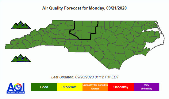
Air quality is in the upper range of green today as ozone and particulate matter levels are exptected to not be a problem today.
Pollen
Pollen levels are expected to be medium today (6.8 out of 12) with ragweed, chenopods, and grasses being the main culprits. Tomorrow is expected to lower (6.0 out of 12).
TROPICAL WEATHER
(The North Atlantic Hurricane Season runs from June 1st to Nov 30th)
Tropical Tidbit from Levi Cowan (video recoded yesterday afternoon)

Tropical Weather Outlook
NWS National Hurricane Center Miami FL
200 AM EDT Mon Sep 21 2020
For the North Atlantic...Caribbean Sea and the Gulf of Mexico:
The National Hurricane Center is issuing advisories on Tropical Storm Beta, located over the western Gulf of Mexico, on Hurricane Teddy, located a couple of hundred miles south-southeast of Bermuda. The National Hurricane Center has issued its last advisory on the remnants of Wilfred, located over the central tropical Atlantic.
1. Post-Tropical Cyclone Paulette is producing a small area of showers and thunderstorms, not far to the southeast of its center of circulation. The system is meandering over marginally warm waters and is expected to begin moving eastward later today. Further development is possible and the system could become a tropical or subtropical cyclone today or tomorrow. For more information about marine hazards associated with this system, see High Seas Forecasts issued by Meteo France.
* Formation chance through 48 hours...medium...60 percent. * Formation chance through 5 days...medium...60 percent.
TROPICAL STOM BETA

Tropical Storm Beta Discussion Number 15
NWS National Hurricane Center Miami FL AL222020
400 AM CDT Mon Sep 21 2020
Beta is struggling this morning. Satellite images show that much of the deep convection associated with the storm has dissipated, and data from the Air Force Hurricane Hunters indicate that the winds have decreased. Based on a combination of flight-level and SFMR data from the aircraft, the initial intensity is lowered to 45 kt. This estimate is also in agreement with an ASCAT pass from a few hours ago that showed peak winds close to 40 kt. It is also worth noting that the tropical-storm-force winds are largely confined to the northern half of the circulation, and these winds should spread across the Texas coast later this morning.
Beta has been moving due westward during the past several hours, with the latest initial motion estimated to be 270/5 kt. In the short term, Beta is expected to resume a west-northwestward motion at a forward speed of about 5 kt, and that motion should take the tropical storm to the Texas coast by tonight. The models differ on how far inland Beta gets over Texas, but the majority of the guidance shows the cyclone stalling just inland on Tuesday in weak steering currents. The combination of an approaching shortwave trough and an amplifying ridge over Florida should cause Beta to turn northeastward along or near the Texas coast late Tuesday and Wednesday, and then farther inland over Louisiana on Thursday. The NHC track forecast is largely an update of the previous one and remains near the various consensus aids.
The tropical storm is certainty feeling the effects of dry and stable air that has wrapped into the circulation. The combination of the dry air mass and 15-20 kt of southwesterly wind shear should limit strengthening through landfall tonight. Steady weakening is forecast after that time due to the storm interacting with land and stronger southwesterly shear. The models are in quite good agreement, and the NHC intensity forecast lies near the high end of the guidance envelope.
Key Messages:
1. The expected slow motion of Beta will produce a long duration rainfall event from the middle Texas coast to southeast Louisiana. Flash, urban, and minor river flooding is likely. Rainfall will also spread northward into the ArkLaTex region and east into the Lower Mississippi Valley and portions of the Southeast through the end of the week. Flash, urban, and isolated minor river flooding is possible.
2. There is the danger of life-threatening storm surge near times of high tide through Tuesday along portions of the Texas and Louisiana coasts within the storm surge warning areas. Residents in these areas should follow advice given by local officials.
3. Tropical-storm-force winds will spread westward across the Texas coast later this morning and continue into Tuesday.
FORECAST POSITIONS AND MAX WINDS
INIT 21/0900Z 27.7N 95.1W 45 KT 50 MPH
12H 21/1800Z 28.0N 96.0W 45 KT 50 MPH
24H 22/0600Z 28.4N 96.6W 40 KT 45 MPH...INLAND
36H 22/1800Z 28.7N 96.5W 35 KT 40 MPH...INLAND
48H 23/0600Z 28.9N 95.8W 30 KT 35 MPH...INLAND
60H 23/1800Z 29.4N 94.7W 25 KT 30 MPH...INLAND
72H 24/0600Z 30.2N 93.2W 25 KT 30 MPH...INLAND
96H 25/0600Z 32.8N 90.5W 20 KT 25 MPH...POST-TROP/INLAND
CROWDFUNDING OR DAY SPONSORSHIP OPPORTUNITIES
If you receive value from what Macon Media provides to the community, please consider becoming a supporter and contribute at least a dollar a month. Those who support Macon Media with at least a dollar a month receive early access to video of some events and meetings before they are made public on the website. Videos and news involving public safety are not subject to early access.
Or, if you prefer Pay Pal, try PayPal.me/MaconMedia
Published at 5:00am Monday, September 21, 2020


0 comments :
Post a Comment