LOCAL OUTLOOK
Cool and dry high pressure will build into the region this weekend. Dry high pressure will persist through the work week with above-normal temperatures returning by mid-week. A weak cold front will approach the area from the north and west heading into next Saturday resulting in a chance for light rainfall.
WEATHER SPONSOR

Adams Products, a Division of Oldcastle is underwriting the daily weather briefing and public safety updates for the month. We have all your masonry products (block, mortars, tools), plus feature Belgrade Pavers and Sakrete Products. Open 7:30 AM to 4:00 PM, M-F, located at 895 Hickory Knoll Road, Franklin, NC. Special Event – Wed 09-20-17 7:30-10:00 AM - OX Tool Fair – Info on FB page.
Visit our Facebook page at: https://www.facebook.com/Adams.Oldcastle.Franklin.NC/
Phone number is 828.524.8545, all are welcome, let us help you with your next project.
Weather Almanac for September 30th (1872-2016)
Record weather events for this date in Macon County
Highest Temperature 89°F in Franklin in in 1954
Lowest Temperature 27°F in Franklin in 1967
Greatest Rainfall 6.53 inches in Highlands in 1936
Record weather events for September in Macon County
Highest Temperature 98°F in Franklin on Sept 4, 1975
Lowest Temperature 27°F in Franklin on Sept 30, 1967
Greatest Rainfall 11.87 inches in Highlands on Sept 29, 1967
THREE DAY OUTLOOK
TODAY
Mostly sunny with highs in the 60s. Locations in the main valley may exceed 70. Winds 5 to 10 mph out of the northeast, shifting to the north after 3 pm and becoming light and shifting again to come from the east around 6 pm.
TONIGHT
Clear with lows in the 40s and a wind chill in the upper 30s in the higher elevations. Winds 5 to 10 mph out of the east, mainly between midnight and 5 am.

SUNDAY
Sunny with highs in the 60s and winds out of the east.
SUNDAY NIGHT
Mostly clear with lows in the 40s and winds out of the east.

MONDAY
Mostly sunny with highs ranging from the mid-60s to the mid-70s.
SUNDAY NIGHT
Partly cloudy with lows ranging from the mid-40s to the lower 50s.
HAZARDS
No hazardous weather is expected.
Please turn on your headlights in the fog for your morning commute so other motorists can see you and increase your following distance to increase your reaction time.
Macon Media maintains a Severe Weather Preparedness Page at http://thunderpigblog.blogspot.com/p/breaking-news-hub.html for those who are interested.
As always, you can check to see what advisories, watches, and warnings are in effect for Macon County by visiting http://is.gd/MACONWARN

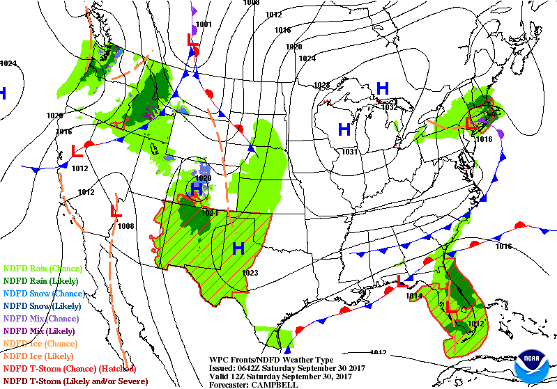
TROPICAL WEATHER OUTLOOK
Tropical Weather Outlook
NWS National Hurricane Center Miami FL
200 AM EDT Sat Sep 30 2017
For the North Atlantic...The Caribbean Sea and the Gulf of Mexico:
The National Hurricane Center is issuing advisories on Tropical Storm Maria, located several hundred miles south of Cape Race, Newfoundland, and on Tropical Storm Lee, located almost 1000 miles west-northwest of the Azores.
1. The interaction of a weak low-pressure area over central Florida and an upper-level low over the Gulf of Mexico is producing disorganized cloudiness and showers that extend from the northwestern Caribbean Sea northward across much of the Florida peninsula and the adjacent waters. Due to the low's interaction with land and an expected increase of upper-level winds over the weekend, the likelihood of this system's development appears to be decreasing. Locally heavy rainfall is still anticipated over portions of western Cuba, the Florida Keys, and the Florida peninsula during the next several days while the system moves slowly northward and then westward near northern Florida and the northeastern Gulf of Mexico.
* Formation chance through 48 hours...low...30 percent.
* Formation chance through 5 days...low...30 percent.
2. A tropical wave interacting with an upper-level low is producing widespread cloudiness and showers extending from the eastern Caribbean Sea northeastward across the Lesser Antilles to the nearby Atlantic waters. Upper-level winds are not expected to be conducive for development while this system moves west-northwestward to westward at 10 to 15 mph during the next few days. However, locally heavy rainfall is expected over portions of the northern Leeward Islands and the Greater Antilles during the next several days, with a Flash Flood Watch in effect for Puerto Rico and the U.S. Virgin Islands through late Sunday night.
* Formation chance through 48 hours...low...near 0 percent.
* Formation chance through 5 days...low...10 percent.
MACON CALENDAR
If you have an event you wish to be added to this calendar, please send the information, along with a flyer in pdf format or a high-quality photo, to editor@maconmedia.com. If you want text published, please include a paragraph with your photo, flyer or graphics. Please include date(s) and time(s).
There is no charge for civic, educational or nonprofit groups, except for groups or events that receive funding from the TDA, TDC, and EDC, where full rates apply.
September 27th, WEDNESDAY
HOSPICE HOUSE FOUNDATION OF WNC
PEACEFUL JOURNEY
3rd annual charity dining event
hosted by RISTORANTE PAOLETTI at 440 Main Street in Highlands
For information, visit http://hhfwnc.org/peaceful-journey/
National Alliance on Mental Illness
Appalachian South
Meets each Thursday at 7pm
The First Methodist Church Outreach Center
at the intersection of Harrison Ave. and West Main Street
(directly across from Lazy Hiker Brewery)
Come join our weekly support group for anyone suffering from mental illness and their family or friends. This includes Depression, Bipolar,8chizophrenia, PTSD, Substance Abuse, Etc.
Here you will find:
— others living with mental health challenges YOU ARE NOT ALONE
- learn coping skills and ?find hope in shared experience
- help learning how to break down stigma and guilt surrounding mental health
- how to live life with the expectation of a better a better future
Kay (706)970-9987 Denise (828)347-5000)
SYRINGE EXCHANGE PROGRAM
On January 1, 2017, the Syringe Exchange Program of Franklin began operating a comprehensive harm reduction program to address the opioid epidemic that is impacting western NC. Opioid overdose reversal kits including naloxone are available free of charge. If you have any questions about our services or if you know someone interested in volunteering, please contact Stephanie Almeida at 828-475-1920.

Sun and Moon
Sun
Begin civil twilight 7:02 a.m.
Sunrise 7:28 a.m.
Sun transit 1:23 p.m.
Sunset 7:18 p.m.
End civil twilight 7:44 p.m.
Moon
Moonset 2:13 a.m.
Moonrise 4:25 p.m.
Moon transit 9:45 p.m.
Moonset 3:09 a.m. tomorrow
Phase of the Moon on September 30, 2017: Waxing Gibbous with 74% of the Moon's visible disk illuminated.
Closest Primary Moon Phase: First Quarter on September 27, 2017 at 10:53 p.m. (local daylight time)
Sky Guides for this week
I took some epic photos of the solar eclipse, but have not yet had time to process them. I will be producing material from the photos and video for sale as a fundraiser for Macon Media. --Bobby
Sky and Telescope Magazine
Astronomy Magazine
Earth Sky has an article on the eclipses of 2017. [LINK]
Heavens Above has an Android App that will assist you in observing the sky and even has a satellite tracker that will let you know when the International Space Station and dozens of other satellites are overhead. [LINK]
Stellarium is also an app that will assist you in observing the sky. It is available in both Android [LINK] and iOS versions. [LINK]
CROWD FUNDING OR DAY SPONSORSHIP OPPORTUNITIES
If you receive value from what Macon Media provides to the community, please consider becoming a supporter and contribute at least a dollar a month.
If you have a business or event you are interested in sponsorship opportunities or underwriting coverage, send an email to editor@MaconMedia.com for more information. Serious inquiries only. Macon Media rewards early sponsors/underwriters with lifetime guaranteed low rates while newer sponsors/underwriters pay higher rates based on the date they first support Macon Media.
Thank You to the people who have been sending in donations and those businesses who are underwriting coverage of news and events. You have kept Macon Media online. You have made it possible for Macon Media to begin purchasing state of the art equipment and begin work on building a real website with features not employed by any local news outlets.
You can find out more information on how to do that and some of what I plan to accomplish if I reach certain levels of funding at
https://www.patreon.com/MaconMedia
Posted at 4:10 am on September 30, 2017
#WNCscan #MaconWx #MaconSafety
Data and information sources: Sources (except where otherwise credited): heavens-above.com, Ian Webster's Github, National Centers for Environmental Prediction, The National Weather Service, National Oceanic Atmospheric Administration, Penn State University Electronic Wall Map, The State Climate Office of North Carolina, Storm Prediction Center, U.S. Naval Observatory, and the Weather Prediction Center.