


This is a truncated briefing. A more complete version will be posted at around 7am. [Click Here for Post ]
GENERAL OUTLOOK
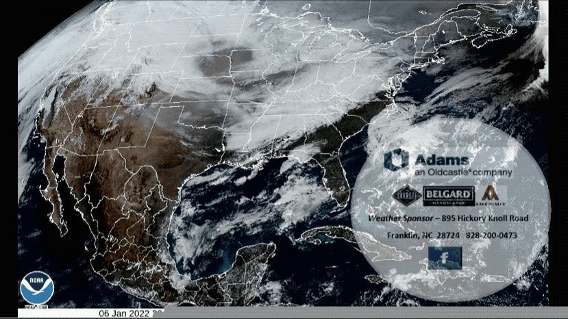
Departing low pressure will move northeast off the Mid-Atlantic coast early this morning, with wintry precipitation ending in the mountains. Cold high pressure will build in from the west and north the rest of today and into Saturday. Another chance of precipitation will develop on Sunday as a cold front enters the area from the west, with the front reaching the Carolina coast early Monday. Dry and cold high pressure will settle over our region through the middle of next week.
SCHOOL ANNOUNCEMENTS
Franklin Area Schools will operate on a two hour delay for Friday, January 7th, 2022.
Nantahala School will operate on a two hour delay for Friday, January 7th, 2022.
Highlands School will be on a two-hour delay for Friday, January 7th, 2022. School will begin at 10:00 am. Please do not drop of students before 9:30 to insure access to the building and proper supervision.
In addition, buses will only pick up students at the following locations: Bus 6 will pick up students at Shortoff Baptist Church on Buck Creek Road at 9:00, and Clear Creek Baptist Church on Blue Valley Road at 9:25. Bus 109 will pick up students at the Scaly Mountain Fire Station on Hale Ridge Road at 9:25.
SPECIAL WEATHER STATEMENT
...AREAS OF BLACK ICE EXPECTED TODAY ACROSS MUCH OF THE NORTH CAROLINA MOUNTAINS...
Temperatures will fall into the teens and lower 20s across the North Carolina mountains this morning. The combination of light snow accumulations along the higher ridges and near the Tennessee border, as well as water from recent rainfall left to freeze on area roadways, will result in areas of black ice developing. The black ice will produce slippery spots on roadways. Temperatures will likely remain below freezing throughout the day in many mountain areas, allowing slippery conditions to persist.
Use caution if driving today in the North Carolina mountains, especially this morning.
General Forecast Through Sunday Night

Franklin Area
Today
Mostly sunny, with highs in the mid-to-upper 30s. Winds out of the northwest 5 to 10 mph.
Tonight
Mostly clear, with lows around 20. Calm winds.
Saturday
Sunny, with highs in the mid 40s. Calm winds in the morning increasing to come out of the south around 5 mph in the afternoon.
Saturday Night
Increasing clouds, with lows in the mid 20s. Calm winds.
Sunday
Showers, mainly after 1pm. Highs in the lower 50s. Light winds out of the south. Chance of rain is 100%.
Sunday Night
Showers, mainly before 11pm. Lows around freezing. Chance of precipitation is 80%.
Highlands Plateau
Today
Sunny, with highs near freezing. Winds out of the northwest 10 to 15 mph, with gusts as high as 30 mph.
Tonight
Mostly clear, with lows around 20. WInds out of the northwest 5 to 10 mph in the early evening becoming calm before midnight.
Saturday
Sunny, with highs in the mid 30s. Winds out of the southeast 3 to 6 mph.
Saturday Night
Increasing clouds, with lows in the mid 20s. Calm winds early in the evening increasing to come out of the southeast around 5 mph before midnight.
Sunday
Showers, mainly after 1pm. Highs in the mid 40s. Winds out of the southwest around 5 mph. Chance of rain is 90%.
Sunday Night
Showers, mainly before 11pm. Lows around freezing. Chance of precipitation is 90%.
Otto and South Central County
Today
Mostly sunny, with highs in the upper 30s. Winds out of the north 5 to 10 mph, with gusts as high as 20 mph.
Tonight
Mostly clear, with lows around 20. Calm winds early in the evening increasing to come out of the southeast around 5 mph after midnight.
Saturday
Sunny, with highs in the mid 40s. Winds out of the south 3 to 7 mph.
Saturday Night
Increasing clouds, with lows in the mid-to-upper 20s. Light winds out of the southeast.
Sunday
Showers, mainly after 1pm. Highs near 50. Light winds out of the south. Chance of rain is 100%.
Sunday Night
Showers, mainly before 11pm. Lows around freezing. Chance of precipitation is 80%.
Nantahala Area
Today
Mostly sunny, with highs near freezing. Winds out of the northwest 5 to 10 mph.
Tonight
Mostly clear, with lows around 20. Calm winds.
Saturday
Sunny, with highs in the mid 40s. Light winds out of the east.
Saturday Night
Increasing clouds, with lows around 30. Calm winds early in the evening increasing to come out of the southeast around 5 mph after midnight.
Sunday
Showers, mainly after 1pm. Highs in the upper 40s. Light winds out of the south. Chance of rain is 100%.
Sunday Night
Showers, mainly before 10pm. Lows around freezing. Chance of precipitation is 80%.
Support Macon Media
If you receive value from what Macon Media provides to the community, please consider becoming a supporter and contribute at least a dollar a month. Those who support Macon Media with at least a dollar a month receive early access to video of some events and meetings before they are made public on the website. Videos and news involving public safety are not subject to early access.
Or, if you prefer Pay Pal, try PayPal.me/MaconMedia
Published at 5:05am on Friday, January 7, 2021
Author: Bobby Coggins


0 comments :
Post a Comment